How To Learn Marine Navigation (Easy In-Depth Guide)
Learning marine navigation can seem difficult, but when you break it up, it's actually pretty simple. Below, I'll go over the exact steps of learning marine navigation quickly.
How to learn marine navigation? In order to learn marine navigation, you need to understand how to locate your position (using bearings, GPS, stars, etc.), how to read nautical charts to determine a course, how to plot a course on a nautical chart or chartplotter, and how to use a compass (in order to monitor the course).
This still might seem like a lot. Don't worry. I have written detailed articles on all of these different steps. Below, I'll summarize the main takeaways for each step, and link to other articles so you can explore in more detail on your own. Ultimately, marine navigation all boils down to the way you get your lines. Let me explain.

On this page:
Fundamentals: how marine navigation works, how to use a boat compass, how to read and use nautical charts, my recommendation for a chart navigation course, my recommendations for navigation gear.
You first have to understand the fundamentals of marine navigation. Marine navigation consists of three very simple steps:
- Locate your position
- Determine a course
- Monitor the course
If you say it like that, it doesn't seem so difficult after all, right? There are all kinds of ways to locate your position, to determine your course, and to monitor the course. That's what makes it seem difficult. But in the end, it's always these three steps. For example:
- You locate your position by using GPS
- You determine a course based on a nautical depth chart and the wind direction
- You monitor the course using a compass or your GPS
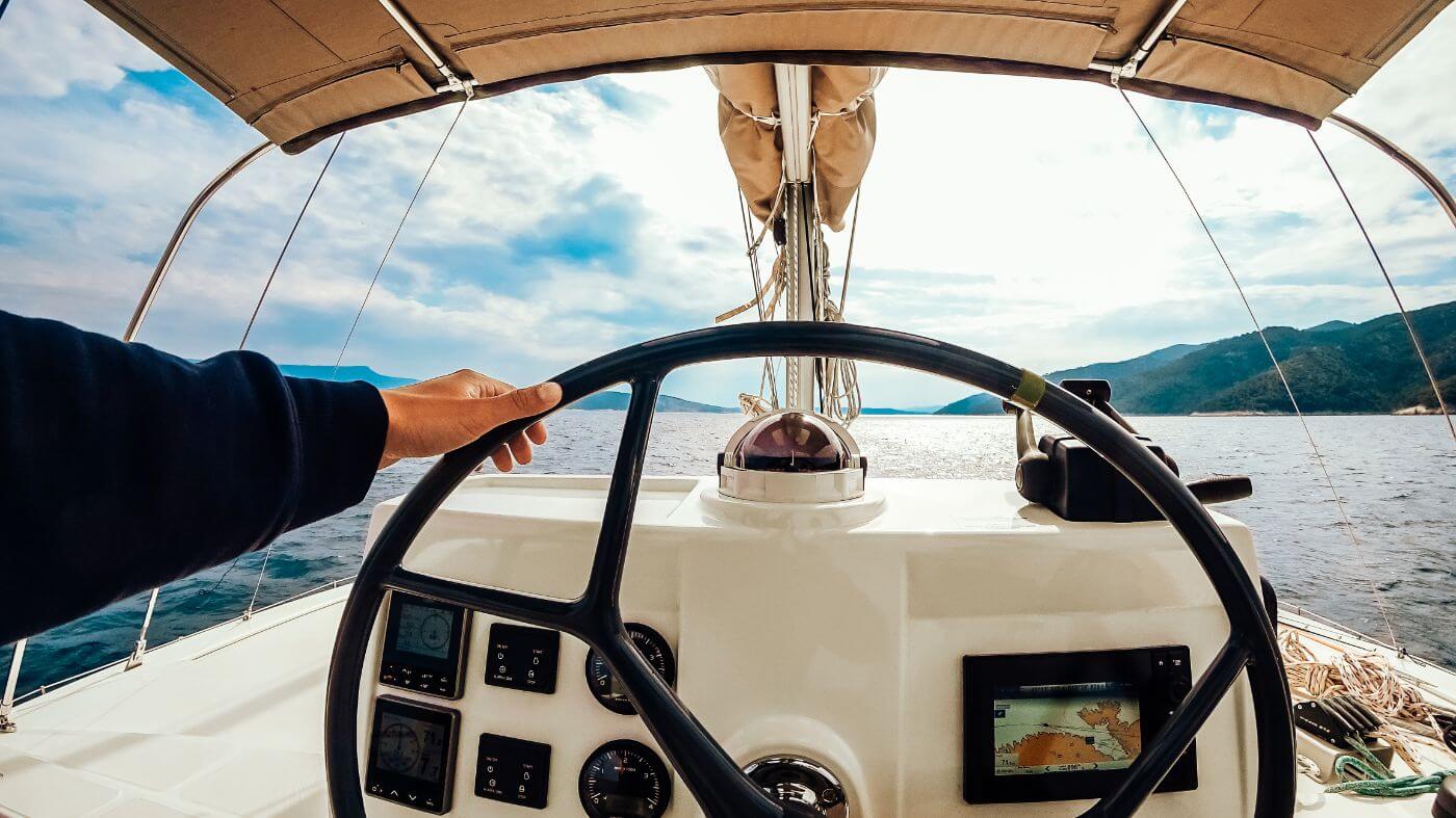
Locating your position can be done with any kind of directional line, for example using landmarks, buoys, stars, or satellites (which is GPS).
Your navigation technique is simply the way you choose to get your lines. It is always recommended to have multiple ways of determining your location, just to be safe in case you have some sort of system failure.
Find all types of marine navigation in my in-depth guide here
Using a boat compass may seem straightforward, but many people make mistakes that are easily avoided. Especially if you're just starting out, it's easy to make mistakes that may have large consequences.
The most common compass is the magnetic compass, which will work 99% of the time. There are situations in which a GPS compass may malfunction. Same goes for the magnetic compass. Having at least one extra back up compass is therefore recommended. Most sailors agree that a solid magnetic compass is the default choice for reliable navigation.

So how do you actually use a boat compass?
- The lubber line (a small line on the compass) marks your direction on the compass card.
- The direction is given in degrees.
- You pick a course on a nautical chart.
- Then, you steer the boat so that the lubber line points to the correct degree on the compass card.
- You keep course by making sure the lubber line stays put.
Most important compass lessons:
- Before leaving the marina, always check your compass' alignment
- Remember or record your reciprocal course - the opposite direction of your course current course. The reciprocal course will always get you home.
- A compass is still an important tool, even with GPS, since a compass tells you direction, not just track.
- You should mount your compass away from metals and electronics, otherwise it will deviate
- You should calibrate (swing) your compass after mounting
The compass will always point to magnetic north. However, the position of magnetic north changes all the time (less than 6 meters per year on the surface). The closer you get to the poles, the larger the navigational error margin becomes.
It's important to understand your compass well If you're new to sailing, I highly recommend reading up on the compass and learn how to use it the right way in this article .
We understand our compass and have a sense of the fundamental concepts of marine navigation. Now it's time to take a close look at nautical charts. William has written a very good series of articles on using nautical charts.
Here's the entire series in the recommended reading order:
- Nautical Chart Types Explained
- Ultimate Guide to Nautical Chart Navigation
- How To Plot a Course on a Chart
William is an experienced sailor (he has sailed the world for eight years) so he really knows what he's talking about. After reading this series you will be up to speed on chart navigation. If you're currently just orienting, I will summarize each article and talk about the takeaways below.
Different types of nautical charts
The most common type of nautical charts are navigation charts , which is what most people refer to when they talk about nautical charts. You'll be using navigation charts most of the time, although there are some other types like pilot charts.
A navigation chart is like a road map, with one important distinction: road maps contain roads, nautical charts don't. Nautical charts are more like geographic maps, showing depths, ridges, islands, shallows and similar features. They also contain important landmarks you can use to determine your position.
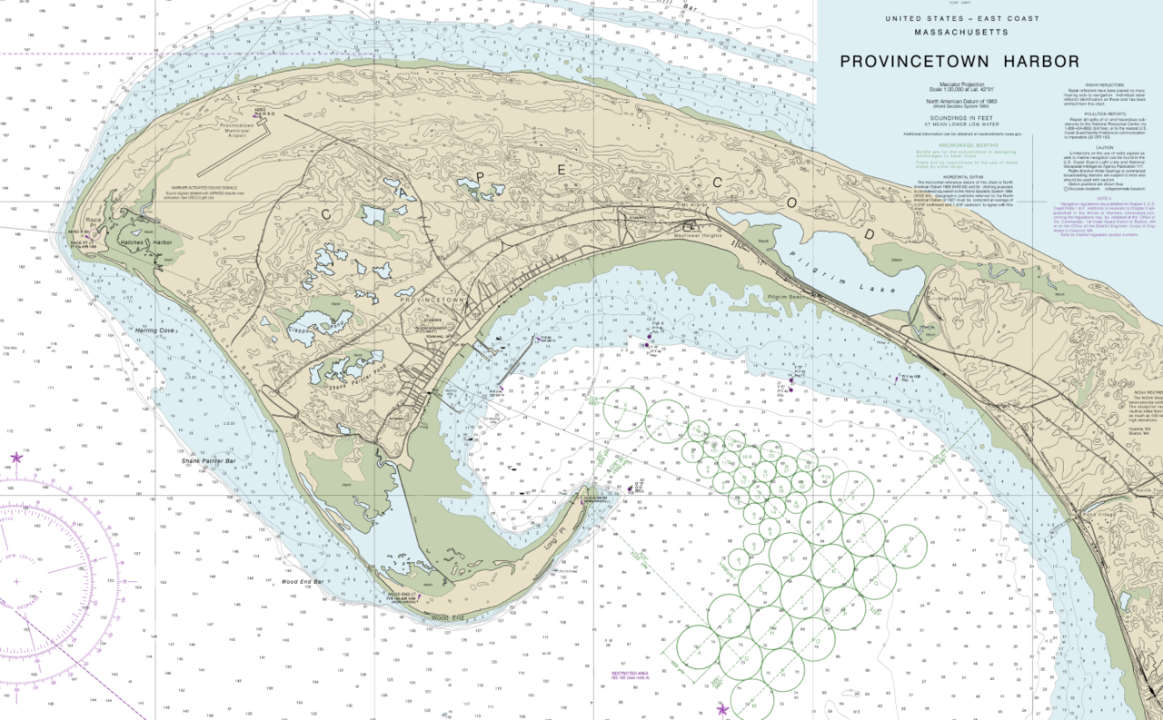
When using a chart, you want to pay attention to the scale. Typically, you want to use the largest scale charts possible , since those contain the most details. These are called large scale charts, coastal charts, general approach charts, or harbor charts. Smaller-scale charts are only useful for planning long voyages. You have to be careful with those since they won't contain every shallow or reef.
For an illustrated overview of the different nautical chart types , I recommend reading this article on chart types .
How to use nautical charts
Using nautical charts is as easy as pie - if you know what each symbol means and how to interpret the excess of information on there. In William's Ultimate Guide to Nautical Chart Navigation , he walks you through each and every item on there, with examples so it's easy to understand.
What you'll need to know in order to navigate safely:
- Navigation basics - what basic tools we have to navigate
- How to read a chart - interpreting all the information on the chart
- How to use a chart - plotting a course
How to read nautical charts
Generally, you'll find the following information on a good chart:
- Latitude and Longitude Lines
- Scales, Depths, and Notes - tides and currents, navigational marks
- Compass Rose - indicates the orientation of the map
- Depths and Contours - small numbers that state the depth of the bottom
- Symbols, Marks and Lights - things like hazards, landmarks, lighthouses
For a detailed explanation of each of these, go read the full guide on nautical chart navigation .

Coordinates
When navigating using nautical charts, we use coordinates to indicate positions. Coordinates consist of a latitude and longitude line. Charts have a geographic coordination scale which you can use to find these lines. Top and bottom of the map show longitude. The sides of the map show lattitude.
Symbols, Marks and Lights
You can find an overview of all the symbols and marks on the U.S. master list, which you can download here:
Download the US Chart Number 1 here (pdf )
Plotting a course on a nautical chart
Now you have the right chart, next up is plotting a course on it. You can use a chartplotter, which is essentially a GPS with a map underneath which does the plotting for you. However, it's still important to learn how to plot yourself, since electronics can (and will) fail at one point or another.
Getting good at plotting takes a bit of practice and an ordered routine. Once you get it down, however, it becomes a piece of cake.
You need three basic navigation tools: a parallel ruler, dividers, and the chart itself.
How to plot a course on a chart:
- Draw a line from point A to B - using parallel rules, from starting mark to next mark
- Check the line for safety - if not, move end mark until you get a safe leg
- Measure and mark the heading - transfer the leg to compass
- Measure and mark the distance - measure the legs
- Repeat until you get there
For more explanation on these steps, please read our article How To Plot a Course on a Chart (Illustrated Guide ).
When you're ready to master chart navigation, I recommend you check out the Coastal Navigation course at our partner NauticEd. It is quite excellent. They cover chart navigation in-depth and will guide you through multiple quality exercises to make sure you really practice your new skills. It is really affordable as well.
You'll leave Coastal Navigation Clinic with an understanding of:
- The Charts and how to use navigation tools
- True north and magnetic north - and variation and deviation
- Determining your position using various techniques such as dead reckoning, running fixes and triangulation
- What to do with your GPS position to get you to your destination
- Set and drift from wind, tides and current
- How to simply determine your heading based on Set and Drift
Check out NauticEd's Navigation Clinic now .
If you're ready to start navigating but are unsure what kind of equipment you should get, you should check out my recommendations. I have previously recommended a good beginner chartplotter, handheld GPS, and boat compass.
My recommendation for a boat compass
I recommend the Ritchie Navigation Explorer (click to check current price on Amazon ) - This compass is competitively priced, good looking, simple, reliable and rugged. Bracket mount (which I like). Also called the B51, it's the all-round best compass for most people. Best bang for the buck.
If you want to read the whole review, you can read my recommendation for a boat compass here.
My recommendation for a chartplotter
I recommend the Garmin echoMAP CHIRP 54cv (check current price at Amazon ) - This chartplotter is good for both inland and bluewater sailing, and made by the best-known brand for marine navigation in the world.
If you're looking for a budget handheld alternative , I'd consider the Garmin Striker 4 (check current price at Amazon ) - This simple handheld chartplotter offers mostly the same functionalities as the more expensive echoMAP, at a really competitive price. Incredibly, it also comes with a transducer, allowing you to use echo.
If you want to read the whole review, you can read my recommendation here.
Thank You Sir how does it feel when a huge wave is about to unravel you in sea when sailing
Leave a comment
You may also like, best marine compass: going the right way cheaply.
If you're serious about sailing, you know that a reliable compass can make all the difference. I've tested many compasses and read tons of reviews of other sailors, …
Best Marine GPS Chartplotter: My top pick for 2021
Own your first boat within a year on any budget.
A sailboat doesn't have to be expensive if you know what you're doing. If you want to learn how to make your sailing dream reality within a year, leave your email and I'll send you free updates . I don't like spam - I will only send helpful content.
Ready to Own Your First Boat?
Just tell us the best email address to send your tips to:
6 Best Marine Navigation & GPS Apps for Boaters (Free & Paid)
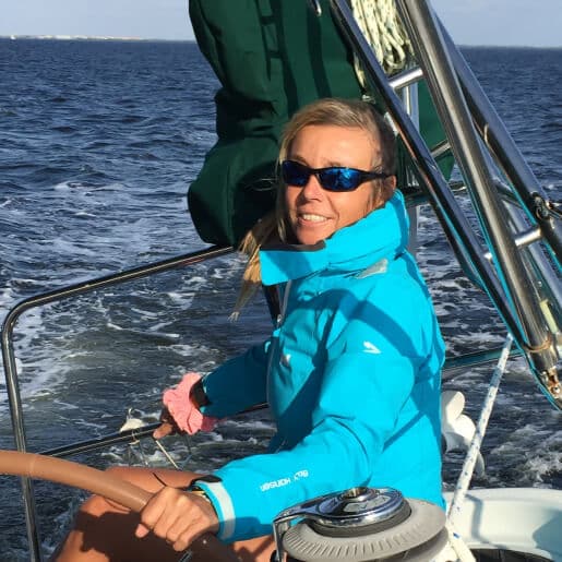
Table of Contents
For almost everything you do today, there’s an app that will support, enhance or complement that activity. Recreational boating is no exception, and there are dozens of boating apps to help you enjoy time on the water.
Arguably, marine navigation apps are some of the most common—and the most useful—available to boaters today, with a range of options to suit different needs. Some boat GPS apps, for example, utilize NOAA raster charts, which are essentially scanned paper charts incorporated into their systems. Some apps offer vector charts, providing electronic charts that allow for scrolling and zooming in for enhanced detail.
The convenience of downloading these apps to your iPhone, Android, or tablet enables you to have them readily available regardless of the boat you’re on, significantly enhancing your navigational capabilities.
Here are our top choices for boat navigation apps:
1. Navionics
A perennial favorite is Navionics because it’s easy to use and comprehensive in scope. Navionics mimics a standard chartplotter experience and in some cases can connect to an onboard plotter via WiFi. Creating waypoints and routes, measuring distances and understanding depth contours and aids to navigation is pretty straight forward with this app.
Once downloaded, the charts stay on your device and can be used offline which is great when you’re cruising in areas with little coverage. Bonus functionality includes weather and tide information and dock-to-dock routing that helps you set a viable course based on your vessel’s parameters like draft.
- Price: Two-week free trial, then subscriptions starting at $14.99
- Click here to learn more and download.
Easy to confuse with Navionics (especially when downloading the app), iNavX is a whole different animal. There’s a $5 charge to download the app, and then you can download NOAA raster charts for free and vector charts (powered by Navionics and C-MAP) for a fee.
Beyond navigation, details on marinas, fuel docks and other facilities are also available. Weather data overlays and additional features like engine data and AIS collision avoidance information can also be viewed, but the app can get technical in a hurry and may take longer to learn.
- Price: $4.99, plus an annual subscription
C-MAP is the primary other choice besides Navionics for the underlying charting information that many apps use with their own user interface. The new C-MAP Embark was designed to be intuitive so after a few minutes, you won’t really be looking for the manual to manage the basics like waypoints, routes and nav aids.
A funky feature includes the app changing color based on your environment, so the charts are always easy to read regardless of the surrounding light. The basics include a free download, but chart additions and weather data will be in-app purchases.
- Price: Free, with available in-app purchases
4. SeaPilot

SeaPilot sets an ambitious agenda for itself: it’s a basic navigation app (which has a free three-day trial) but it ramps up from there. You’ll need to upgrade to the premium version so you can add various chart areas, weather forecasting and routing capabilities. Beyond that, you can connect to Facebook to find nearby boating friends.
For sailors, there’s a database of polar diagrams which are graphs of the theoretical top speeds attainable by over 300 kinds of sailboats.
- Price: Three-day free trial, then starting at $7.99
5. i Sail GPS:NOAA USA Charts
For barebones basics, iSail is a great choice because it’s inexpensive and you can skip sign-ups and pop-ups. Measure distances to your waypoint, upload waypoints and routes and get quick ETAs to your next intermediate or final point.
iSail uses NOAA raster charts which are downloaded to the device so they can be used without Wi-Fi or out of cell range. There are few advanced features, but this app gets the job done when you need the basics. It’s for iOS only.
- Price: $7.99, with available in-app purchases
6. KnowWake

The best way to describe KnowWake is to compare it to a road-based app you’re probably already familiar with–Waze. Like Waze, KnowWake is crowd-source and will provide information on congested waterfront locations–coastal and on 350 inland waterways.
On a bustling weekend, you can see how busy marinas, restaurants, boat ramps, fuel docks, and dive and snorkel sites are. You can use it in North America, on the Great Loop and in Canada as well as in parts of the Caribbean. The app uses real-time updates and it has location-sharing between users so you can find friends.
- Price: Free!
All the boating apps above vary in price, complexity and focus, and although some are free, advanced features generally come at a price. Some take a bit of time to learn, but they’ll all put some peace-of-mind in your pocket the next time you slip the dock lines.
Bonus Apps: Boatsetter
Did you know Boatsetter has an app? Make that two! We’re proud to offer the largest peer-to-peer boat rental app that connects boat owners and boat renters, so you can get on the water without committing to boat ownership. Rent one of over 17,000 boats in 600 locations. Boatsetter isn’t the only private boat rental app , but it offers an exclusive partnership with BoatUS and Geico for insurance.
- Price: Free! (Boat owners should also check out our Boatsetter Owner’s app , perfect for stress-free boat rental management and easy communication with renters).
- Click here to download for iOS ; or click here to download for Android .
Browse Available Boat Rentals in All Locations

Zuzana Prochazka is an award-winning freelance journalist and photographer with regular contributions to more than a dozen sailing and powerboating magazines and online publications including Southern Boating, SEA, Latitudes & Attitudes and SAIL. She is SAIL magazines Charter Editor and the Executive Director of Boating Writers International. Zuzana serves as judge for SAIL’s Best Boats awards and for Europe’s Best of Boats in Berlin.
A USCG 100 Ton Master, Zuzana founded and manages a flotilla charter organization called Zescapes that takes guests adventure sailing at destinations worldwide.
Zuzana has lived in Europe, Africa and the United States and has traveled extensively in South America, the islands of the South Pacific and Mexico.
Browse by experience
Explore articles
5 Best Beaches in Key Largo
Watersports Basics: How to Get Started
How Much Does a Boat Motor Cost
Things to Do at Lake Conroe
Last Updated on June 24, 2022 by Boatsetter Team
- Yachting World
- Digital Edition

Best navigation apps: 6 top options tested
- November 16, 2021
There are many app options on the market for sailors wishing to navigate from a smartphone of tablet. Bruce Jacobs looks at some of the best navigation apps on the market.

It’s increasingly rare these days to see any sailor without at least one navigation application on their phone, while tablets are even preferred to fixed multifunction displays (MFDs) on an increasing number of yachts. It’s great to have this navigation information so easily to hand and so mobile, but which are the best navigation apps for sailors and how do they compare.
Sailors need slightly different information to motorboaters. It’s nice to know if it’s going to be sunny, but we care more about whether the tide will be foul or fair. We need to know what the wind direction will be and whether it’s going to be an angle we can use, over and above nearby places of interest.
We looked at the most popular navigation apps, particularly from a sailor’s perspective, and highlighted what we think works well for yachting and what is best left to the motorboaters.
The absolute number one benefit of an app is the ability to instantly see where you are, on up-to-date charts, without the cost and immobility of an MFD. Every app we tested has that core functionality and, ultimately, you will get good basic use out of any of them.
Thereafter, to my mind, most of these apps have been developed with the leisure powerboater in mind. They are focused on short day trips under engine or maybe going fishing to fairly well known areas. Wind, tide and current have little impact in these scenarios beyond whether it is sunny or the anchorage is accessible.
Fast and reliable
Having spoken to a range of sailors, it’s clear that the universal requirement is for an app that delivers fast, reliable data within an intuitive interface. We want charts that show sensible levels of detail as we zoom in and out and, critically, will warn us when we need to zoom in more to see dangers that might have been hidden by vector charts.
We then want all the other essential information such as wind and current instantly accessible and able to be overlaid on the chart, and we want to be able to quickly measure distance and bearing to a relevant point.
But despite some decent contenders, the truth is that not one app delivers it all. Adding in extras such as AIS, boat data, autorouting and more is great, but that foundation level functionality should come first.
Savvy Navvy, the newcomer to the world of navigation apps, shows what the modern app could be. It is possibly the only app built with yacht sailors at the forefront and gives easily accessible wind, current and tide overlays to sensibly detailed charts. Its routing algorithm was the only app we tested that accounted for current, and its passage plans mapped out beautifully informative courses to steer.
It also recognises hazards such as tidal races and Traffic Separation Schemes (TSS). But its algorithm is too ambitious in the level of detail it tries to extrapolate from GRIB files and the app took us into dangerous shallows and routed us metres off hazards and lee shores in strong winds.
The app is nearly the absolute game changer it should be – but its programming sophistication has outstripped its seamanship and that’s an issue.
The other apps proved a mix in how suitable they are for sailors. Basic features such as wind and current were not universally available. Also often lacking were tools such as those measuring distance and bearing.
Frustrating menus
I found some of the routing software frustrating as I was made to go through multiple menus to load and select waypoints, rather than just touch two points on the screen. And some of the apps appear to have had data sources and functionality added over time, without the redesign they might then need to bring it all into one easy-to-use interface.
AIS data is a nice new feature, but some apps rely on an internet signal for it – others can link by wifi to your AIS device. Knowing how often internet signal drops on a yacht even close to land, I’m not sure I’d trust the type that doesn’t connect to the onboard AIS.
Crowd sourced data is also an increasingly common addition to the charts. Some love it for adding real time accuracy, but others claim it can be dangerously inaccurate. I suspect both are true so, as with everything, the prudent skipper should treat all information with a healthy dose of caution.
For the best mix of functionality, breadth of data and reliable information, Navionics + remains my app of choice. But if ( and it’s a big if) Savvy Navvy becomes more savvy with its seamanship – it will have everything it needs to revolutionise the sector and become the sailor’s app of choice.
Best Navigation apps for sailors:

C-Map on an iPhone
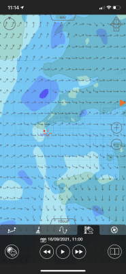
C-MAP produces my favourite charts, with just the right amount of detail for spot depths, enlarged navigational marks on land and sea and clever colouring. Wind data via GRIB files is easily overlaid and the colour shading system both makes it easy to see predicted wind speeds and discourages the user from trying to extrapolate unrealistic detail.
However, there is no tide and current overlay, which is a frustration for sailors, and it is also a disappointment that there is no satellite imagery overlay. C-MAP’s automatic routing system is fairly easy and intuitive to use but having allowed me to set a minimum depth of 3m, it would then suggest routes that contravened this limit, albeit giving a second option that didn’t. Some caution is therefore required.
Get C-Map app from the Apple App Store Get C-Map app from the Google Play Store
Note: We may earn a commission when you buy through links on our site, at no extra cost to you. This doesn’t affect our editorial independence.
Read our full C-Map navigation app review

Navionics app on a phone
Navionics Boating app
This app is intuitive and easy to use. Charts are quick to render and auto zooming of detail is probably best in class. Text is used to good effect and tells you when you need to zoom in to get more information about hazards (one of the dangers of vector charts). Arrows showing current are animated to show strength, direction and whether the tide is on the ebb or flood. Frustratingly, you have to access a different window to get GRIB/wind data, when it should surely just be an option on screen.
The Navionics Sonar option allows charts to be adapted to show depths based on real time user data from thousands of vessels, but the company sensibly warns that many other factors (such as barometric pressure) will have a considerable affect on depths.
Get Navionics+ app from the Apple App Store Get Navionics+ app from the Google Play Store
Read our full Navionics + navigation app review
Savvy Navvy app on desktop or tablet
Savvy Navvy
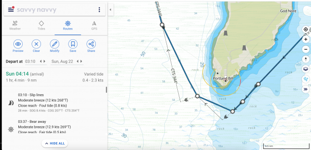
Savvy Navvy is a sophisticated app with all the key information ready to be switched on or off at your fingertips. It is the only app that has a routing algorithm that has inputs for wind and current (although bizarrely not leeway) and then plots a beautifully drawn course to steer. It is useful to be able to enter later or earlier departure times and see the impact on wind and tide.
Charts are a little light on detail for my liking – my sense being that artistic merit has slightly usurped navigational utility. A bigger issue with Savvy Navvy is that the sophistication of the programming for its route planning has not been matched by that of the seamanship. It extrapolates impossibly detailed wind patterns from the GRIB data and uses performance polars that cannot be adjusted – both of which make the plans interesting to look at but of little practical use.
Get Savvy Navvy app from the Apple App Store Get Savvy Navvy app from the Google Play Store
Read our full Savvy Navvy navigation app review

Seapilot app on a phone
This app is based on some features of the professional ECDIS charting systems and in many ways has some of the best features – but while some will not agree, personally I found it unintuitive to use.
The significant issue, however, is that the autozoom on its charting detail just doesn’t work in many regions. Until I zoomed in to a small area (maybe five square miles) there was so much clutter on the screen that there was not much that could be done. Even when zoomed in, information about navigational marks would often be overlaid on spot depths, making both impossible to read. Seapilot acknowledges that some regions suffer from this as an issue due to the use of ECDIS data and hopes to rectify it going forward.
The app also uses ECDIS warning symbols for some hazards, which leisure sailors won’t be familiar with.
Get Seapilot app from the Apple App Store Get Seapilot app from the Google Play Store
Read our full Seapilot navigation app review
isailor featues nice wind colouring
iSailor is another app that works well as an extension to your boat’s onboard systems. It will connect to the NMEA system and internet AIS, although each feature you unlock costs money. The alarms menu is comprehensive, including anchor drag, waypoint proximity, loss of GPS signal and a low battery warning.
Charts were fairly good, but as with Seapilot, I had issues with the auto detail of the chart at various zoom levels and had data overlaid on each other. I also found that at certain levels of zoom, key data such as spot depth was removed, but too soon for my liking. If I want to plan 2-3 miles ahead I want to see clear depth data, not just coloured contours.
Get iSailor app from the Apple App Store Get iSailor app from the Google Play Store
Read our full iSailor navigation app review

iNavx on a phone
iNavX can be frustrating to use at first because there is so much to customise that it can be tough to get into. Persevere, however, and you’ll find a good app. It has a range of chart options including Navionics, C-MAP and NOAA. They partner with Waterway Guides, which gives micro level detail for marinas and other facilities, although the UK version is yet to arrive.
While all the information is there, I didn’t find interrogation of chart data as easy as, say, the Navionics app, but this may just be personal preference. I also found building and adjusting routes frustrating. There is a very comprehensive manual that can be accessed and a range of excellent YouTube instructional videos – but honestly, I’d rather just be able to work it out quickly and easily on the app.
Get iNavx app from the Apple App Store Get iNavx app from the Google Play Store
Read our full iNavx navigation app review
If you enjoyed this….
Yachting World is the world’s leading magazine for bluewater cruisers and offshore sailors. Every month we have inspirational adventures and practical features to help you realise your sailing dreams. Build your knowledge with a subscription delivered to your door. See our latest offers and save at least 30% off the cover price.
U.S. Coast Guard Auxilary
Modern Marine Navigation
The boatus foundation and the united states coast guard auxiliary present modern marine navigation.
Prepare early and put your mind at ease.
About the course.
Whether you want to improve your navigational skills on your local waters, or you’re longing to cruise in foreign and exotic locations, Modern Marine Navigation will help you on your way to become a better boater conveniently, in your own home.
Interactive Exercises
Quiz Questions
With this course you will learn the basics of plotting, reading charts, identifying ATONs and using them to find your way on the water as well as an introduction to electronic navigation all presented online where you can study at your own pace. This is the only navigation course to be completely vetted by the US Coast Guard Navigation Center.
Sign up and start Navigating like a pro today!
Other Specialized/Advanced Boating Courses

How to Use GPS

Sailing Lingo

Planning Your Cruise

All About Marine Radio

Hurricane Preparation for Boaters

Boating On Rivers, Locks, and Lakes

Weather for Boaters

Learn to Sail

Crew at the Helm

Clean Boating Course

Spill Prevention for Marina Staff

Navigation for the modern boater
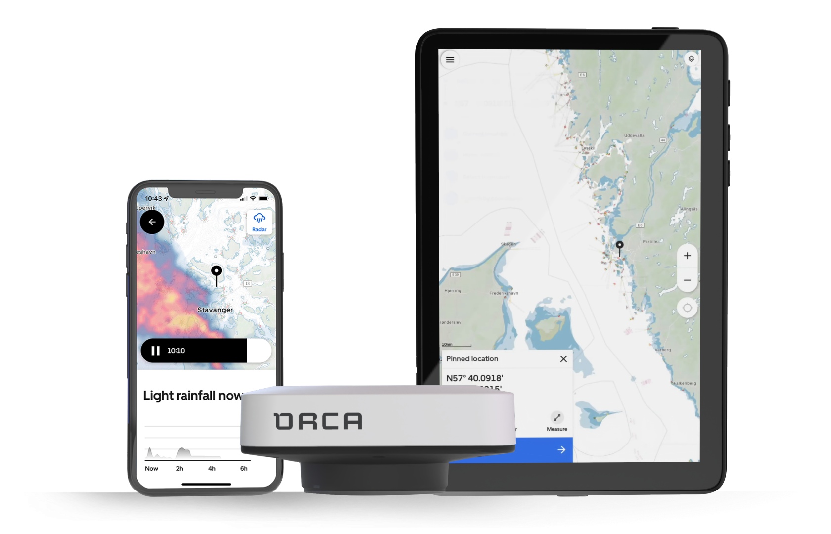
The ultimate navigation display. Made for sunshine.
Advanced boat integration. Pinpoint accuracy. Total control.
The latest updates
Remote Access - Check your vessel’s status from anywhere
Bringing peace of mind to all boat owners.
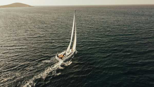
Introducing Rerouting for Sail Routes
A new approach to navigation for sailboats
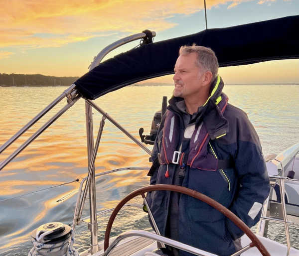
Alastair's journey with Orca
Learn how Alastair uses Orca onboard his Jeanneau and Linssen.
Which Orca is right for you?
Get a personal recommendation >
2024 © Orca. All rights reserved.

Navigation Lights for Sailboats (And How To Read Them)

Last Updated by
Capt Chris German
June 15, 2022
Navigation lights on a sailboat can be confusing. If you understand the reason behind why they are the way they are however, they can make a lot more sense.
At their heart, sailboats are really just a power boat and as such must adhere to all power boat rules such as navigation lights. Other times however, a sailboat is classified in a special category. They have a set of additional lights they CAN show as an option, but are not always required to do so.
That’s about as clear as mud if you ask me and I contend that that is where the confusion about lighting a sailboat begins.
Just because you can show a light to identify yourself in times of low visibility, does not mean you have to and then we add in a little sibling rivalry between power and sail and things get downright adversarial when it comes to navigation and the night.
Table of contents
The USCG says You’re a Power Boat Whether You Like It or Not
Much to the consternation of many a sailor who has earned a commercial license to drive their sailboat, when you received your credential from the USCG it says you are a master of steam and power across the top with no mention of wind as a source of propulsion.
It is not until you read the back pages of your little red book that feels like a passport and looks like a US Sailing credential, that you will see the term “sail auxiliary”. That is because most of the time the U.S. Coast Guard knows that you are primarily reliant on your mechanical power to propel your vessel.
It's a sad thing, but the days of commercially viable sail boats are done and all but the most select few even have sails let alone use them as their primary power source. All sail boats by law are powerboats, but not all powerboats are sailboats.
Navigation Lights for a Power Boat
As a power boat, you are required to show certain lights and have been required to do so before power was even invented.
In the days of man powered vessels like the viking ships who relied on oars while in close quarters to power their vessels, they needed to show other boats, friend or foe, where they were by showing lanterns in the dark to identify themselves. As you know, it is a time honored rule among all the nations of the world both past and present, that you must avoid a collision at all costs while at sea and even the viking knew that you should not run into things.
By lighting the front and back of your boat, you could warn other boats of your presence as well as identify which way you were heading. As such there is a very specific rule in the Code of Federal Regulations Number 46 (CFR46 by common name) that spells out with detail how many, the color, the luminosity or brightness, the angle of visibility and the location of all of the lights required for navigation on every single boat, seaplane, submarine and other nondescript vessel conceived by man to date that they must show while underway in reduced visibility.
And there is no flexibility in the rules.
As such a power boat, and by extension all sailboats, MUST, without question show one green light on the starboard bow and one red light on the port bow and one all around white light or lights while operating in reduced visibility. These lights should shine at all 360 degrees of visibility with the bow lights shining at an angle of dead ahead to 22.5 degrees abaft the beam and the stern lights shining 225 degrees dead aft. A forward facing masthead light that is white in color shall shine forward to comply with the directive that all vessels must carry an all around white light. For more read here .
As you can see, there isn’t much wiggle room when it comes to lights that must be shown.
Sailboats get a little flexibility with lights
Sailboats however, are a little different when they are in fact sailboats, which is only when you are entirely reliant on the wind for power and in no way reliant on any mechanical or manual means of propulsion. And for good reason.
Back in the day when men were men and sailboats were wooden, fire was a major concern. Sails were coated with wax and other flammable substances and the wood on boats was saturated with oils and grease. Even the ropes were plant materials saturated with oils to keep them pliable and strong.
Add those highly flammable substances to a parching environment like the sea and you had what was essentially a giant floating tinderbox.
Then tell that giant floating tinderbox that they need to identify themselves to the world at large at night using oil lamps with flames because batteries and lights were not invented yet. It didn't take very long or very many ships burning to the water line for the Governments to say to the sailboats, you get to do things a little different.
As such, sailboats are given special dispensation when it comes to lights aloft. They don't have to show an all around white light in their rigging because no one wanted to set their rig on fire with oil lamps 60 feet up in their rig.
However, when a sailboat takes their sails down such as when they are powered or at anchor, they must resume the display of an all around white light or lights aloft. That became a real challenge with aluminum masts and the disappearance of rat lines on the shrouds because there was no easy way to climb the rig and check the bulbs up the mast on a regular basis.
Red over Green Sailing Machine
I have no idea where the history of this particular light comes from, but if you ever take a deck exam with the USCG, you better remember this mnemonic. An all around red light over an all around green may be displayed on a vessel during times of reduced visibility to indicate that a vessel is operating under sail power alone.
I won’t even speculate on how or why they came up with this particular light configuration, but if you want to use these lights as a sailing vessel, you can do so, but that means that you will need three all round lights at the top of your mast, an all around white, an all around red and an all around green, just in that order.
The red over green is to be displayed in addition to the running lights or the red and green bow lights with the 225 degree stern light. As always, when the motor comes on, so does the steaming light or the forward facing white light that is also usually about ¾ of the way up on your mast to complete the requirement of an all around white light that indicates a power vessel.
What is a “steaming light” and why are you mentioning it now?
Most sailboat electrical panels will have a switch that is labelled “steaming light” and it will only come on when your anchor light is off. This is probably the most confusing part of sailboat navigation lights so if you are confused about this, you're in good company as most people are.
A “steaming” light is named thusly, going back to the days of steam powered sailboats where when they fired up their boilers and doused the sails, they became a power boat once again. There aren’t too many steam powered boats, let alone steam powered sailboats, but the name stuck and it is a vestige of a bygone era.
Either way, when you fire up your motor, you turn on your “steaming light” and that locks out the all around white light which is used for anchoring to minimize the number of switches on your panel and reduce the number of wires in your mast. The fewer wires, the less chance of something not working or becoming disconnected.
The steaming light and the anchor light both go up the mast, but you can’t use an all around white light while using the 225 degree stern light at the deck level because to other boaters you would look like you have two white lights from the stern and that would be confusing.
The anchor light is used exclusively for anchoring while the steaming light is used to indicate you are a power vessel while underway.
As to why I am mentioning it now in the article, is because this would have blown your mind if I started with this subject cause it can be really confusing stuff.
Aspect Recognition with Lights
Remember when I said earlier that lights can help you tell others which way you are heading as well as tell you which way other boats are heading? That is called the aspect of the vessel and the USCG tests you on this for your deck exam as well.
Knowing that the bow lights go 22.5 degrees abaft the beam on both sides or 112.5 degrees on each side, and the stern light faces 225 degrees aft for a total of 360 degrees of visibility, you can tell a lot about where a boat is heading and who has the right of way.
One thing that's easy to remember is red means stop and if you see a vessel's red light, it means stop as you are the give way vessel and approaching the other vessel from his port side. Conversely it works with green as well as that means you are approaching from the other vessel's starboard side and you are the standon vessel.
If you see a red and green light equally low on the horizon, that means your heading dead on into another vessel's path and conversely if all you see is a white light low on the horizon, it means you are overtaking another vessel power or sail, we don’t care because it is an overtaking situation. However, any time you do see a white light aloft in addition to the red and green bow lights, you know you are encountering a power boat.
Then there are angular approaches as well, where you see white and red or white and green light low on the horizon. You know in that case you are seeing a portion of the bow lights and stern lights from the side approaches of a vessel. Based on which direction those lights are heading, you can deduce which way that boat is going in relation to your boat.
So put it all together and you see a green light and a white light low on the horizon with a red over green light aloft, you know that you are approaching a sailboat that is traveling to your port and that might make you the standon vessel. That is of course, if we didn’t concern ourselves with windward and leeward and port tacks and starboard tacks, but that is a discussion for another article. So stay tuned when we talk about sailing rules and the right of way. But for now, do good, have fun and sail far.
Related Articles
Capt Chris German is a life long sailor and licensed captain who has taught thousands to sail over the last 20 years. In 2007, he founded a US Sailing-based community sailing school in Bridgeport, CT for inner city youth and families. When Hurricane Sandy forced him to abandon those efforts, he moved to North Carolina where he set out to share this love for broadcasting and sailing with a growing web-based television audience through The Charted Life Television Network.
by this author

Most Recent

What Does "Sailing By The Lee" Mean?
Daniel Wade
October 3, 2023

The Best Sailing Schools And Programs: Reviews & Ratings
September 26, 2023
Important Legal Info
Lifeofsailing.com is a participant in the Amazon Services LLC Associates Program, an affiliate advertising program designed to provide a means for sites to earn advertising fees by advertising and linking to Amazon. This site also participates in other affiliate programs and is compensated for referring traffic and business to these companies.
Similar Posts

How To Choose The Right Sailing Instructor
August 16, 2023

Cost To Sail Around The World
May 16, 2023

How To Drive A Pontoon Boat
Jacob Collier
December 19, 2022
Popular Posts

Best Liveaboard Catamaran Sailboats
December 28, 2023

Can a Novice Sail Around the World?
Elizabeth O'Malley

4 Best Electric Outboard Motors

How Long Did It Take The Vikings To Sail To England?

10 Best Sailboat Brands (And Why)
December 20, 2023

7 Best Places To Liveaboard A Sailboat
Get the best sailing content.
Top Rated Posts
Lifeofsailing.com is a participant in the Amazon Services LLC Associates Program, an affiliate advertising program designed to provide a means for sites to earn advertising fees by advertising and linking to Amazon. This site also participates in other affiliate programs and is compensated for referring traffic and business to these companies. (866) 342-SAIL
© 2024 Life of Sailing Email: [email protected] Address: 11816 Inwood Rd #3024 Dallas, TX 75244 Disclaimer Privacy Policy

- Find A School
- Certifications
- North U Sail Trim
- Inside Sailing with Peter Isler
- Docking Made Easy
- Study Quizzes
- Bite-sized Lessons
- Fun Quizzes
- Sailing Challenge

American Sailing Quick Guide to Navigation Rules
By: Zeke Quezada, ASA Sailing Tips
It never fails, you are out for a daysail and another vessel decides that the great expanse of ocean is too small and they sail directly at you. Do you know who has the right of away? Do you understand your responsibilities?
These are the U.S. Coast Guard Inland Navigation Rules that specifically apply to sailing vessels. Navigation rules apply to all vessels and they can be found here: https://www.navcen.uscg.gov/navigation-rules-amalgamated
Sailors who have taken ASA 101 and 103 will have already encountered some of the Steering and Sailing Rules (Part B of the Navigation Rules). ASA 104 requires knowledge of those rules (Rules 4 through 19) and the General Rules (Part A) that define terms and specify how the rules apply.
The ASA 104 certification does not cover sailing after dark. However, since reduced visibility occurs in rain and fog during daylight hours, all sailors need to know the relevant rules in Part C (lights and shapes) and Part D (sound signals). Thorough knowledge of the Navigation Rules is critical to making safe passages on the water.
ASA recommends that all sailors study the full rules.

Take a look at these tips from Bareboat Cruising Made Easy , the official manual for ASA 104 Bareboat Cruising Course.
Avoid Collisions
Note that Rule 2 recognizes that in some circumstances a vessel may have to diverge from the Rules so as to prevent a collision if another vessel doesn’t meet its obligation under the Rules: Everyone is responsible when it comes to avoiding a collision
Rule 2 – Responsibility
(a) Nothing in these Rules shall exonerate any vessel, or the owner, master, or crew thereof, from the consequences of any neglect to comply with these Rules or of the neglect of any precaution which may be required by the ordinary practice of seamen, or by the special circumstances of the case.
(b) In construing and complying with these Rules due regard shall be had to all dangers of navigation and collision and to any special circumstances, including the limitations of the vessels involved, which may make a departure from these Rules necessary to avoid immediate danger.
It is important to understand that a Sailing Vessel is such only if the sails are up.
Rule 3 – General Definitions
Rule 3b – The term “power-driven vessel” means any vessel propelled by machinery.
Rule 3c – The term “sailing vessel” means any vessel under sail provided that propelling machinery, if fitted, is not being used.
The Lookout Rule
Rule 5 – lookout.
Every vessel shall at all times maintain a proper look-out by sight and hearing as well as by all available means appropriate in the prevailing circumstances and conditions so as to make a full appraisal of the situation and of the risk of collision.
Perhaps the most important rule of all is Rule 5, the “Lookout Rule.” Everyone on board should be in the habit of being on lookout all the time. As a bonus, while scanning the water for hazards you might see a school of porpoises or a breaching whale.
Rule 6 – Safe Speed
Every vessel shall at all times proceed at a safe speed so that she can take proper and effective action to avoid collision and be stopped within a distance appropriate to the prevailing circumstances and conditions.
Study the Charts
Sailboats must not impede vessels restricted by draft to using a marked channel (Rule 9). In some busy areas, Traffi c Separation Schemes keep incoming and outgoing ships apart. Pleasure craft are not obliged to use these “divided highways” if an alternative route is available, and it’s always best to avoid them wherever possible.
Rule 9 – Narrow Channels
(a) A vessel proceeding along the course of a narrow channel or fairway shall keep as near to the outer limit of the channel or fairway which lies on her starboard side as is safe and practicable.
(b) A vessel of less than 20 meters in length or a sailing vessel shall not impede the passage of a vessel that can safely navigate only within a narrow channel or fairway.
Rules 12 to 15 establish which vessel, in a situation where the risk of collision exists, is the give-way vessel and which is the stand-on vessel. Rule 16 states that the give-way vessel shall take “early and substantial action to keep clear.” Rule 17 states that the stand-on vessel must maintain its course and speed — unless the give-way vessel fails to meet its obligation to keep clear.
Note that the rules use the expression “stand on,” not “right of way.” No vessel has the right to collide with a vessel that does not meet its obligations.

Rule 12 – Sailing Vessels
(a) When two sailing vessels are approaching one another, so as to involve risk of collision, one of them shall keep out of the way of the other as follows:
- when each has the wind on a different side, the vessel which has the wind on the port side shall keep out of the way of the other;
- when both have the wind on the same side, the vessel which is to windward shall keep out of the way of the vessel which is to leeward;
- if a vessel with the wind on the port side sees a vessel to windward and cannot determine with certainty whether the other vessel has the wind on the port or on the starboard side, she shall keep out of the way of the other.
(b) For the purposes of this Rule, the windward side shall be deemed to be the side opposite that on which the mainsail is carried or, in the case of a square-rigged vessel, the side opposite to that on which the largest fore-and-aft sail is carried.

Rule 13 – Overtaking
(a) Notwithstanding anything contained in the Rules 4-18, any vessel overtaking any other shall keep out of the way of the vessel being overtaken.
(b) A vessel shall be deemed to be overtaking when coming up with a another vessel from a direction more than 22.5 degrees abaft her beam, that is, in such a position with reference to the vessel she is overtaking, that at night she would be able to see only the sternlight of that vessel but neither of her sidelights.
(c) When a vessel is in any doubt as to whether she is overtaking another, she shall assume that this is the case and act accordingly.
(d) Any subsequent alteration of the bearing between the two vessels shall not make the overtaking vessel a crossing vessel within the meaning of these Rules or relieve her of the duty of keeping clear of the overtaken vessel until she is finally past and clear.

Rule 14 – Head-on Situation
(a) ‹‹ Unless otherwise agreed ›› when two power-driven vessels are meeting on reciprocal or nearly reciprocal courses so as to involve risk of collision each shall alter her course to starboard so that each shall pass on the port side of the other.
(b) Such a situation shall be deemed to exist when a vessel sees the other ahead or nearly ahead and by night she could see the masthead lights of the other in a line or nearly in a line and/or both sidelights and by day she observes the corresponding aspect of the other vessel.
(c) When a vessel is in any doubt as to whether such a situation exists she shall assume that it does exist and act accordingly.

Rule 15 – Crossing Situation
(a) When two power-driven vessels are crossing so as to involve risk of collision, the vessel which has the other on her own starboard side shall keep out of the way and shall, if the circumstances of the case admit, avoid crossing ahead of the other vessel.
Related Posts:

- Learn To Sail
- Mobile Apps
- Online Courses
- Upcoming Courses
- Sailor Resources
- ASA Log Book
- Bite Sized Lessons
- Knots Made Easy
- Catamaran Challenge
- Sailing Vacations
- Sailing Cruises
- Charter Resources
- International Proficiency Certificate
- Find A Charter
- All Articles
- Sailing Tips
- Sailing Terms
- Destinations
- Environmental
- Initiatives
- Instructor Resources
- Become An Instructor
- Become An ASA School
- Member / Instructor Login
- Affiliate Login
It's like Google Maps for boats.
Charts, weather, tides... Everything you need in one place.

Over 1 Million Downloads

4.7 out of 5 Over 5,000 5 Star Reviews

RAD NAV APP
I use Savvy Navvy daily for all my inshore fishing here in south Texas. Great for current conditions, including tides and wind direction. It’s like Google maps for boaters. Plan routes, mark your fishing spots and return to the dock in one piece. Every time! Great App 5 stars.
2 weeks ago during the heatwave, we were on the Solent and the temperature fried all our instruments including the GPS plotter. Thank god we had Savvy Navvy as it worked perfectly for the entire weekend and allowed us to do everything we wanted. People say these kind of apps aren’t meant to replace the instruments on board, well I can confirm that when they instruments on board all fail, this was an absolute lifesaver. Can’t wait to test it in other countries.
Great and simple to use
I sail with friends and families and this app is a great way to illustrate “dads” boring chart work through a much more teenage friendly platform. I use both for cross reference and find it pretty accurate. Considering the price of charts it is extremely good value.
Award winning navigation app

British Marine Business of the Year 2023

Great British Entrepreneur Awards Scale-Up of the Year 2022

Seedrs Entrepreneur of the Year 2019

It's free.
No credit card required., powerful features to supercharge your navigation., savvy charts.
We licence UKHO, NOAA and other official hydrographic office charts from around the globe. Our designers build savvy charts from the ground up to show essential marine information with a clean and easy-to-view interface.

View local tide data from over 8,000 tidal stations around the world. Easily view high and low tide with savvy tidal graph and check tidal streams with our visual chart overlay.
GPS Active Tracking
View your live position and check your Course Over Ground (COG) and Speed Over Ground (SOG) instantly. Circles around your location quickly show the distance between your boat and key features around you.

savvy charts come equipped with a detailed wind direction map. All of our plans cover the entire globe - a true world wind map at your fingertips!
Weather Forecast
Scroll through the marine weather forecast to view the changing wind direction, speed and weather conditions.

Route Planning
Plot, move and delete way-points with ease. Then savvy navvy will plan the best route based on the departure time, chart, weather, tide and boat data. Export your route for use with your chart plotter.
Estimate Your Arrival Time
Never be late again. Plot a route from A to B to get a quick and easy estimation of your distance to travel, fuel requirements and time of arrival.

Fuel Efficiency
Custom boat settings let you estimate fuel usage based on your engine cruising speed and boat fuel efficiency.
Schedule departure time
See at a glance the best time to depart based on your route, wind & tidal conditions, see the demo .

And Many More Amazing Features!
Course to steer.
See tidal stream information and get a recommended Course To Steer (CTS) on your screen with a detailed preview of each section of your route .
Marina & Anchorage Information
Check the seabed, weather protection, amenities, number of berths, maximum boat length, contact information, and more, for marinas and anchorages. Plan ahead for a better night’s sleep!
Night & Satellite Modes
Protect your night vision with savvy night mode and use satellite overlay to take a more detailed look at marinas and anchorages.
Offline Charts & Weather
Download chart and weather data for use offline. Save chart packs for the areas where you’re sailing so you can continue to use all your favourite savvy navvy features even when sailing off-grid.
Export Routes
Plot your route with savvy navvy then export your route to a GPX file. This can be used with your onboard chart plotter for active navigation.
Dedicated Customer Support
We have a dedicated team on-call within the savvy navvy app to answer any questions you have, wherever and whenever you need us.
Discover How savvy navvy Makes Navigation Simple.
Watch our quick demo video of the main features of savvy navvy.

Frequently Asked Questions.
Have questions? We’ve answers. If you can’t find what you're looking for? Check out our knowledge base or feel free to get in touch
Chart Coverage.
Get access to all savvy charts, without paying anything extra. Check whether we have coverage in your boating area.
We Work with a Wide Variety of Marine Companies.

Don’t Just Take Our Word for It.
Hear from our users, professionals and leisure boaters alike.

I’m learning navigation and after i’ve plotted my route I check with savvy navvy and can see whether there’s a big difference. It’s like having someone check your homework!

The main theme behind our conversation today has been around unravelling some of the mystique behind trips out into the maritime and coastal environment and the more tools that people are able to pick up and use to help them understand that environment the better.
Tools like the savvy navvy app, and the information provided through the application is unbelievably useful to help people on that journey.

An excellent way forward and definitely my number one planning and checking tool.
I signed up as a Founding Member as I could see the great benefits of savvy navvy. The data is out there and I believe this application will bring it together to provide a useful route planning tool.
Savvy navvy has the weather, it has the tide, it has the charts, it just does it for me.
Already a must-have navigation tool for sailors!
It’s a great idea to have an app like savvy navvy that enables people to cross-check their plans to ensure they haven’t made any mistakes.
A potential life-saving app. The product creation and subsequent business model development has been inspiring.
.jpg)
savvy navvy is hands down the best in the market, I have been using it since it first came out as Beta and that is why as soon I knew you guys were opening paid subscribers, I jumped in.
savvy navvy simplifies a whole range of different tasks that, as a skipper, you need to do. As soon as you test it, you just realise how easy it is to use, and how valuable it is!
I love it! First I do normal navigation on charts, then I use savvy navvy as a second check to give me a good idea of the best tacks to do, subject to tide, which I understand is coming soon! I even use it just to see the wind direction at home to assess what the mooring is like!
We Have Been Featured In.


Looking for something to wear?
We have a range of merchandise to suit the whole family, on or off the water.
Ready to Take Your Boating to the next Level?
Download savvy navvy boat app for iOS or Android today with a 14 day free trial.
Download savvy navvy boat app for iOS or Android today.
iOS & iPadOS.
Download savvy navvy, to start your free trial.
Download today, it’s free!

Sailing Navigation: Basic Rules
Content provided by US SAILING .
Four Basic Navigation Rules for Sailing Situations
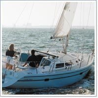
- Port-tack boat gives way to the starboard-tack boat – upwind or downwind. If two vessels might come close or collide, the stand-on vessel maintains course and speed. The give-way vessel alters course and/or speed to pass at a safe distance. (see Image 1 below)
- Windward boat gives way to the leeward boat on the same tack, whether sailing upwind or downwind. (see Image 2 below)
- Overtaking boat gives way to the vessel ahead, whether a sailboat or powerboat.
- Recreational powerboats generally give way to sailboats. It\'s true most of the time. Stay away from working power vessels, fishing boats, ferries, tugboats, barges, and ships, especially in navigational channels.
Join Our Newsletter!
Get community news, buying bargains, and how-to guides at your fingertips.

FREE shipping on $100+ Orders
You have no items in your shopping cart.
Enter Your Search Term Below
Ready to race.

Winter's Here!
Layer up and keep warm, free gill duffel, with os2 jacket & trousers purchase, next stop annapolis oct 12th - 15th, shipping restrictions apply, free shipping use code, raftfreeship, datrex liferafts, free shipping use code raftfreeship, viking | winslow | revere | switlik | datrix | sea-safe | superior, it's boat show season, shop online boat show specials, haul in the savings, spinlock, helly hansen, patagonia, gill, zhik, & more, zhik on sale now, made for water, sale ends sunday 7/23, up to 25% off select items, waterway guide, and skipper bob, independence day, let freedom ring, gill os series, built for all extremes, holiday specials, winter savings, save big in march, you're going, gift giving guide, boxing week deals, through new years, be prepared, independence day, on water confidence, island dreams, start planning, landfall holiday, boxing day sale, black friday sale, huge musto mpx sale, save 30% off, independence day, let freedom ring, update your charts, labor day sale, haul in the savings, check out select safety sale items, stop by and take a look — just off exit 6 on i-95, summer tent sale, friday & saturday june 25-26th, online sneak peak today, helly hansen, mustang & more, memorial day, wheter near or far, ring in savings, weather instruments, boxing week sale, what boaters want, holiday specials, happy birthday henry, end of year event, landfall holiday specials, 25% off gill, pre-holiday savings, patagonia for fall, gear up as the weather turns, end of summer specials, dress for every condition, viking rafts, just in case, free shipping, use code raftfreeship20.

Adventures Await
Plan & outfit for your next trip, essential equipment, charts, & cruising guides, winter sale, featuring, helly hansen, patagonia, prana, kari traa, fish hippie & more, specials are winding down, some are already expired, follow the flags to, our fall tent sale savings, fri & sat, mon oct 6th-7th & 9th, 151 harvard ave, stamford ct, mustang pfds, banner text, life jackets save lives, save 20% on our most popular pfds, optimist, c420, & laser, parts & boats, looking to escape, or plan for the coming season, holiday gift guide, we know what sailors/boaters want, black friday continues, just in case, that time of year again, labor day sale, big savings, beacons save lives, acr beacons, acr end of year event, your last resort, datrex liferafts, free raft shipping, datrex & viking, think survivability, restrictions apply, introducing the regatta life raft, use code raftfreeship21, to business addresses only, datrex liberty rafts, to lower 48 business addresses only, helly hansen savings, clothing & foul weather gear, gill 25% off sale, end of summer savings, save 25% off, cool nights sale, summer sales continue, shirts, shorts & shoes, 25% off helly hansen, all new summer shoes, bags, and clothes, big gill savings 40% off, ends today tuesday 3/24, big gill savings, 40% off or more, on most items, datrex & sea safe rafts, price & free shipping promo, steiner binoculars, see your way through the storm, use code raftfreeship19, carry a liftraft, be prepared, free shipping now, good for business addresses only, summer savings.
With Gill Orders Over $125.
Enter Code GILLBAG In the Cart.
Introducing, the new os2 system.
Refined and and updated to make the best even better.
MEMORIAL DAY 25% OFF
Free 5l dry bag, summer can be chilly.
LAYER-UP CHOOSE THE MOST EFFECTIVE
BASE, MID AND OUTER LAYERS FOR ANY ACTIVITY
The Sea Can Be Unforgiving
2024 bermuda race supporter, featuring: acr, wichard, spinlock, waterway guide and more, acr, spinlock, stohlquist, wichard, and more, save 15% on, waterway guides, cruise with local knowledge, helly hansen, 25% off and more, spend $175 get free hh wash bag, independence sale, helly hansen & more, mustang pfds, top sellers on sale now, past season, your year round go to, musto mpx 2, men's & women's, in stock ready to ship, be safe with mustang pfds, khimera and more, paper charts, get home safely, musto holiday sale, bermuda race gear, musto mpx 30% off, patagonia for any weather, save on mustang, 2021 boat show specials, labor day pfd sale, dog days of summer deals, helly hansen, vesper spring rebate, get up to $100 back, gill for spring, for adventure, many @ 25% off, with coupon, landfall gift cards, always appreciated / always on-time, buy your boaters, nautical books, labor day sale 25% off, plan & cruise like a local, america's great loop, planning guides and charts, sperry sale, the original & more, spring savings, automatic 10% savings @ checkout, weather instruments, epirb cash back free gift offer acr epirb promo --> gill fall & winter buy gill --> save $30 + buy pfd + re-arm & save --> summer sale 25% off, shirts, shorts & more, patagonia 30% off.
GIVE THE GIFT ALL YOUR SAILORS CAN USE
Maritime Tribes
Introducing our new line of nautical chart themed scarves & blankets
Remember Spring Sailing can be cold
Featuring: helly hansen, patagonia, kari traa etc., nautical themed gifts, spinlock pfds, on sale now, labor day sale, chart your summer plans, plan on going south, pre-summer sale, gill and corkcicle, plus skipper bob books, waterway guide sale, 25% off now, landfall gift cards, always on time and appreciated, special holiday pricing 25% off, black friday, 25% off holiday special, gill - all new os1, introducing melin hats, celebrate father's day, new for spring, maximum instruments, save 15 to 20% off, pre-holiday, 25% off gill, falling prices, boatshow shoe blowout, save 40% off, are you ready, the greenwich collection, worldwide charts, for primary & backup navigation, gill for fall & winter, see us at annapolis.
Oct 10-14 ~ Tent C-46
September 27th - 29th
151 harvard ave, stamford ct off exit 6, boat show time, winter sale.
SOME RESTRICTIONS
HENRI LLOYD
SAVE UP to 40%
On the most popular gear
New Year New Adventures
Plan for your next trip, see us there tent c #46, tent sale time, fri, sat, mon oct 6-7th & 9th, mustang pfds, summer savings, winter sale, musto mpx sale, let freedom ring, sale now outside, on water confidence, what boaters want, winter's here, boat show time, see you in annapolis oct 12th - 15th, mustang, spinlock, patagonia, helly hansen, gill, & more, save up to 30%, spinlock, patagonia, helly hansen, gill, & more, waterway guide, plus skipper bob, gear up today, gill os foul weather, save big in february, clothing sale, free shipping with code raftfreeship, be prepared, boats and parts, think survivability, introducing the regatta life raft, viking raft, july 4th sale, all new shoes, bags, and clothes, most 40% off or more, ends today tues 3/24, life raft sale, datrex and sea safe rafts, 10% off steiner binoculars, use code steiner10, free gift with purchaser, nano puff - your year round go to, men's & woman's, dog days of summer sale, stay dry with musto, musto for spring, gill spring sale, plan & cruise like a localon, labor day 25% off, black friday specials, featuring: acr, mustang, wichard, spinlock and more, spinlock pfds on sale, labor day sale, chart your summer plans, gill, corkcicle, e-gift cards, falling leaves, united stated boat show, landfall crew favorites.

Helly Hansen Crew Midlayer Jacket - Womens
$165.00 $82.50.

Helly Hansen Crew Vest - Womens
$125.00 $62.50.

ACR ResQLink 450 AIS / PLB with RLS

Musto GTX MPX Pro Offshore Jacket 2.0 - Mens

Dubarry Ultima Boot

Myerchin Titanium CREW Pro

Spinlock Deckvest 6D 170N Life Jacket
$389.00 $339.99.

ACR ResQKit GlobalFix V6 EPIRB & RapidDitch Survival Kit
$823.05 $699.99.

Musto MPX GTX Pro Offshore Trousers 2.0 - Mens

Kong Double Line ORC Tether

Mustang Hydrostatic Inflatable Automatic PFD w/ Harness

A Berth to Bermuda

Wichard Double Tether - US Sailing
$383.20 $249.00.

Mustang Hydrostatic Inflatable Automatic PFD

Gill - Tarp Barrel Bag 60L
![sailboat navigation Wichard Lyf'Safe Jackstays 45' Jackline [14M]](https://cdn.landfallnavigation.com/media/catalog/product/cache/1/image/170x170/9df78eab33525d08d6e5fb8d27136e95/s/j/sjl7053_.jpg)
Wichard Lyf'Safe Jackstays 45' Jackline [14M]
$330.00 $229.00.

Spyderco Atlantic Salt Knife

Maximum Harbormaster Tide - Brass
$245.00 $220.50.

Zhik PFD USCG Approved - Unisex
$119.99 - $134.99.

Waterway Guide Northern - 2024

Spinlock Deckvest 6D HRS 170N Life Jacket
$409.00 $339.99.

Helly Hansen Crew Vest - Mens

Mustang EP 38 Ocean Racing PFD

Helly Hansen Crew Midlayer Jacket - Mens

Mustang ELITE 28 Hammar Auto PFD

Mustang Minimalist Inflatable Belt Pack PFD
$109.99 $79.95.

Helly Hansen Crew Hooded Jacket - Womens

Helly Hansen Crew Hooded Jacket - Mens

Waterway Guide Bahamas

Waterway Guide Mid Atlantic ICW

Waterway Guide Chesapeake Bay
The navigator.

- Expert Advice
Explore our blog for advice, safety alerts, news and more!

Nautical Charts
If your electronics cut out, you need to be ready to use paper charts.

Training Courses
USCG Launch Operator's License, celestial navigation and more!
- Boats & Parts
- Gifts & Galley
- Training Center
- News & Articles
- Safety Alerts
- Shopping cart
- Customer Service
- Shipping Information
- Returns & Refunds
Retail Store
- 151 Harvard Avenue Stamford. CT 06902
- Driving Directions >
- Mon: 9 AM - 5 PM
- Tue: 9 AM - 5 PM
- Wed: 9 AM - 5 PM
- Thur: 9 AM - 5 PM
- Fri: 9 AM - 5 PM
- Sat: 9 AM - 3 PM
- Sun: CLOSED
- Toll Free (800) 941-2219
- Local (203) 487-0775
- Fax (203) 487- 0776
Apparel Deals

Privacy Policy | Terms of Use | Copyright 2024 Landfall Navigation. All Rights Reserved.
- BOAT OF THE YEAR
- Newsletters
- Sailboat Reviews
- Boating Safety
- Sailing Totem
- Charter Resources
- Destinations
- Galley Recipes
- Living Aboard
- Sails and Rigging
- Maintenance

Sailboat Navigation in the South Pacific
- By Birgit Hackl and Christian Feldbauer
- Updated: January 8, 2020
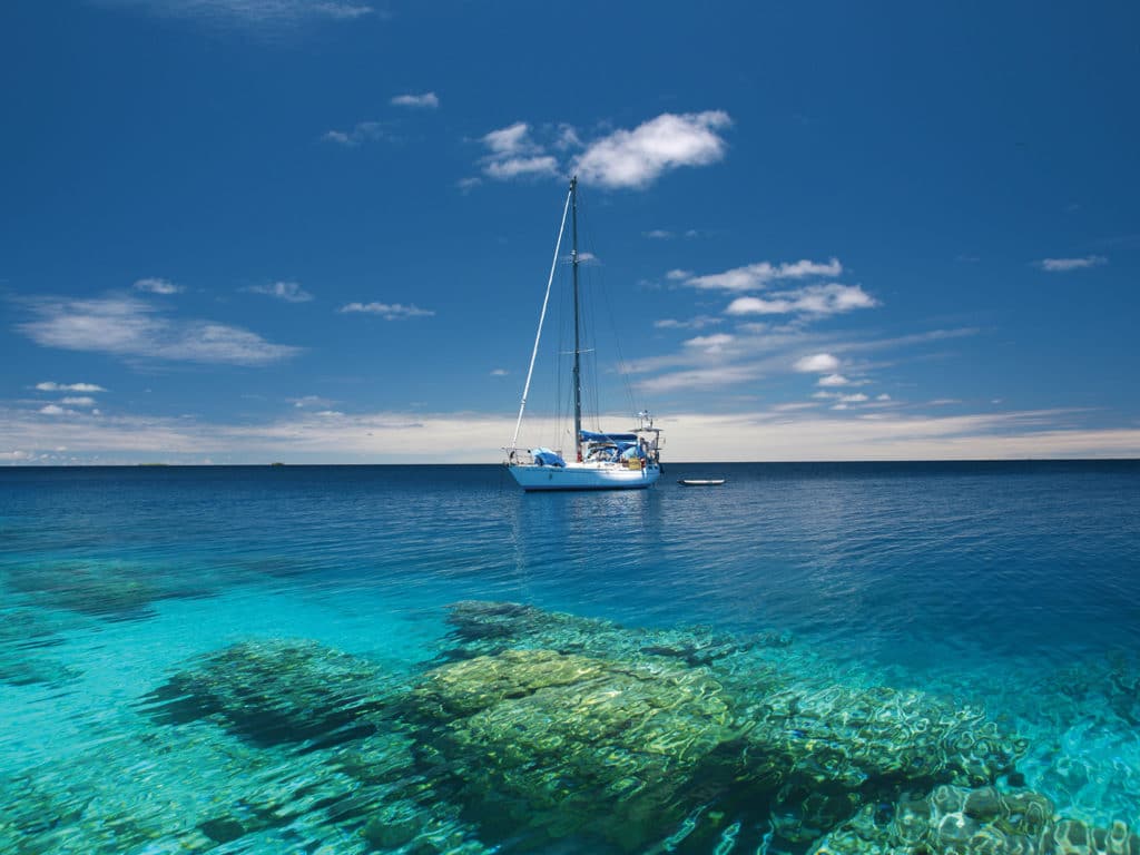
Each year cruisers set out across the Pacific in search of sparkling lagoons, white sandy beaches and colorful coral. Unfortunately, the many atolls that are scattered throughout this region tend to hide their hazards, which can lead to the dream ending in a nightmare if boat meets reef. Some crews underestimate tricky lagoon passes or end up trapped in anchorages on a lee shore after wind shifts. So, is it safer to give those turquoise atolls a wide berth? Absolutely not—it just takes some preparation, caution, and a good dose of common sense to minimize the risk and live the dream of the South Seas without a nasty awakening.
Lagoon Passes
Coral reefs grow in tropical waters, frequently around volcanic islands. The cones of these volcanoes sink back into the sea over millions of years, while the coral keeps growing. In the end, only a reef ring with sandbanks and low motus (the Polynesian word for island) remains around a lagoon. Many reef rings are completely closed and therefore less interesting for sailboats, but others feature passes that allow entry into the protected lagoon.
Three years ago, we approached our very first reef pass in Tahanea, in the Tuamotu Archipelago of French Polynesia. After reading horror stories about strong currents, standing waves that threaten to broach the boat, and eddies ready to twirl the unexpecting helmsperson toward deadly rocks, we felt more than just a bit nervous. We were almost disappointed when the broad pass lay quite unspectacularly ahead at slack water without showing any of the expected phenomena. Since then we have spent three seasons in the Tuamotu and Society Islands of French Polynesia , explored numerous atolls, and managed to enter through the infamous passes of Maupiti, which are negotiable only in calm conditions, and Maupihaa, which is less than 200 feet wide. Still, a certain tension remains whenever we approach an unknown atoll.
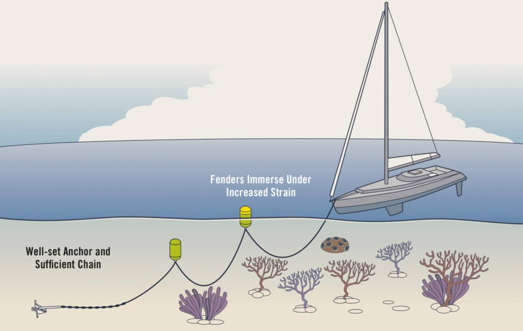
Coral-Friendly Anchoring with a Floated Chain
In advance, we compare electronic charts and satellite images to check for offsets. Upon arrival, we take our time, watch out for signs of currents, and tack up and down near the pass waiting for slack water. Steep, short waves and eddies outside the pass show that the current is still outgoing (especially noticeable when the wind is against the current), while the same conditions inside the lagoon indicate an incoming current. Tide tables are often unreliable, and the times of slack water are influenced by many factors. During and after a period of strong winds and/or high swell, the water level inside lagoons is generally higher and the outgoing current stronger, and it might persist even during the rising tide. It is therefore not advisable to attempt tricky passes in such conditions. Crews on a tight schedule with planes to catch or guests waiting are of course tempted to sail despite adverse circumstances, but it saves nerves and adrenaline to patiently wait for benign weather when hopping between atolls.
Lagoon Navigation
Once through the pass, the harsh ocean conditions remain outside, but you still have not necessarily reached a safe harbor. Wind and sea can still be rough inside the lagoon. Atolls stretch over many miles, and the fetch over such distances is more than a cruising yacht can comfortably (or safely) weather when anchored on the lee shore. So quite often it is necessary to cross the lagoon to find a safe anchorage.
Many atolls are poorly charted, if they’re charted at all. Sometimes charts give the illusion of detailed information, which then turns out to be offset, incomplete or utterly wrong. We rely on eyeball navigation with a lookout on the bow. It is best to explore unknown areas on clear days with the sun high up in the sky, and when coral heads (frequently called bommies) gleam out from afar in the dark blue of the lagoon. Polarized sunglasses filter away reflections and improve visibility.
When the sun is low in the sky, it is impossible to distinguish reefs under the glittering surface of the sea. On days with white clouds like cumulus or a high-altitude haze, visibility is also impaired. When rain clouds darken the sky, reefs can be clearly seen, but as soon as it starts pouring down, visibility above and below the surface goes down to zero.
In murky water, such as when the lagoon is churned up due to strong winds or a high swell breaking over the reef, it is also difficult to spot bommies. We therefore take advantage of sunny days to explore the lagoon and find anchorages for different wind directions, marking dangerous coral heads near the route on the chart plotter. In case of a sudden wind shift, we can always cross over to the safe side of the atoll, even during squalls. When planning routes, we work extensively with satellite images to get the big picture of the location, but also to find promising anchoring spots.
Anchoring in the Lagoon
In calm conditions, any anchorage will do, but 15 knots of wind are already enough to raise an uncomfortable chop across the lagoon. Anchorages along the reef shelf on the windward side of the atoll are protected from waves, but to get out of the wind, you have to anchor rather close to a motu.
Sometimes reefs and sandbanks form natural harbors or at least breakwaters inside lagoons. Such shapes can be seen clearly on satellite pictures, and anchorages behind coral formations are of course particularly pretty and great for snorkeling. Unfortunately, waves can typically make it over such reefs at high water, so it can get quite bouncy.
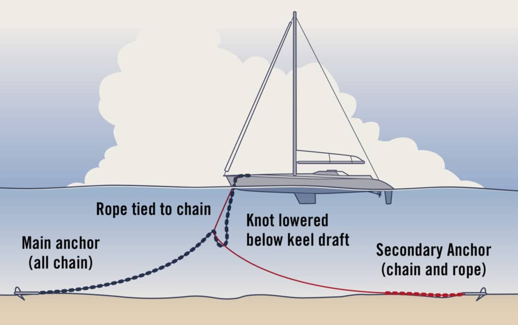
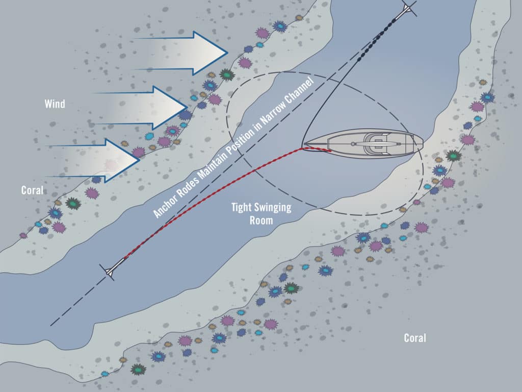
Bahamian Moor in Tight Spots or Currents
Once you have reached the protected side of the lagoon, the quest for a large, sandy spot to drop the hook starts. It helps to scrutinize high-resolution satellite images beforehand. On Pitufa , our 41-foot aluminum sloop, we strictly avoid damaging corals, so the search for an anchoring spot can take a while. As a rule of thumb, bommies are less numerous on the shallow reef shelf (3 to 15 feet) than in deeper (15 to 40 feet) areas—additionally, if you anchor in the shallows, you have the benefit of floating in minty swimming-pool colors.
Because many lagoons are not charted, it is necessary to sound the area cautiously. Slowly maneuvering in the shallow water is rather exciting in the beginning, but you quickly learn to distinguish the different shades of the water and to read them as depths: turquoise over sand, and green to brown over coral. Don’t forget to take a look at the tide table before deciding on an anchoring spot.
If the sandy patch is not big enough to swing around with sufficient scope, environment-conscious cruisers float the chain using fenders or buoys. Sadly, we often had to watch neighbors fouling their chain in coral, either due to a lack of awareness, experience or adequate anchoring gear. Questioned about their motives, the reply is usually an indifferent shrug or paltry excuses. Recently, some old salts shocked us by stating their usual method of anchoring was to drag the anchor until it gets stuck in coral, as their Delta anchor would not set in sand. The results of such behavior are desolate rubble fields underneath popular anchorages, and anchoring bans, which then keep out eco-friendly cruisers as well. A fouled chain is not only an environmental issue, but it can also endanger the safety of the boat when the anchor is stuck in an emergency situation.
Of course, it is true that floats partly nullify the weight advantage of a chain. It is therefore important to have as much scope as possible before hooking in the first fender, and to properly set the anchor. In locations with currents—for example, in narrow lagoon channels—a floated chain can lead to problems. Especially in combination with gusts, the fenders can float next to the hull (or even worse, one to port and one to starboard), and the chain can start scraping the keel. In such conditions, a Bahamian moor is a safer, if a somewhat more-complicated and -laborious alternative.
Keep Moving
No matter how pretty the anchorage, it is always a good idea to keep an eye on the weather and be prepared for changes in wind direction. On Pitufa , we get weather forecasts and GRIB files each morning, sometimes via our 3G data modem but mostly via Pactor modem on the SSB radio. Thus we can plan ahead for the next few days. When will the current anchorage become uncomfortable? Where can protection be found after the wind shift? When is it wise to start moving?
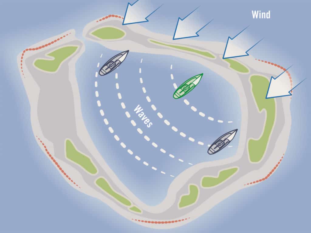
Why Are Waves Always Abeam?
There’s no one right answer. If you wait until the wind has shifted, you will have to motor against the wind or tack all the way. If you trust in the weather forecast and move in anticipation, you will have a nice sail across the lagoon, but there will still be waves once you reach the other side, and the forecasted shift might never happen.
In French Polynesia, we often meet cruisers who are proud of having done many of the Tuamotus in a short time. Those who rush through the atoll chain will be able to look back at thrilling (or nerve-racking) passes, but they will not have really experienced an atoll. Patient cruisers who explore all corners of a lagoon during wind shifts are rewarded with picture-perfect remote motus with bird colonies and pristine coral reefs. Only crews who spend a longer time at anchor off a village have the chance to make friends with the locals and get an insight into the culture, daily life, and challenges of communities on such remote and often quite barren islands. The pace of life there is slow—so relax, take your time, and live the dream.
Birgit Hackl, Christian Feldbauer and ship’s cat Leeloo set out in 2011 from the Mediterranean, and sailed via the Atlantic and Caribbean to the South Pacific, where they have spent the past four years.
- More: Anchoring , How To , navigation , print 2020 winter , seamanship , south pacific
- More How To
How to Prep for a Diesel You Can Depend On
Anchoring in Paradise

Cruising with a Pet

Fatty Goodlander: Have Little, Want Less
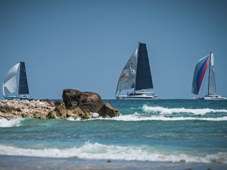
Navigating the Caribbean Regatta Season
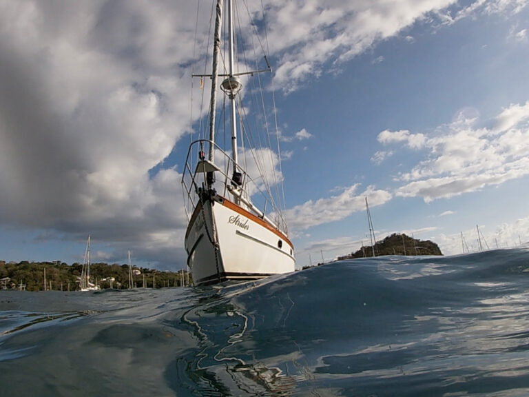
Sailboat Review: Beneteau Oceanis 37.1
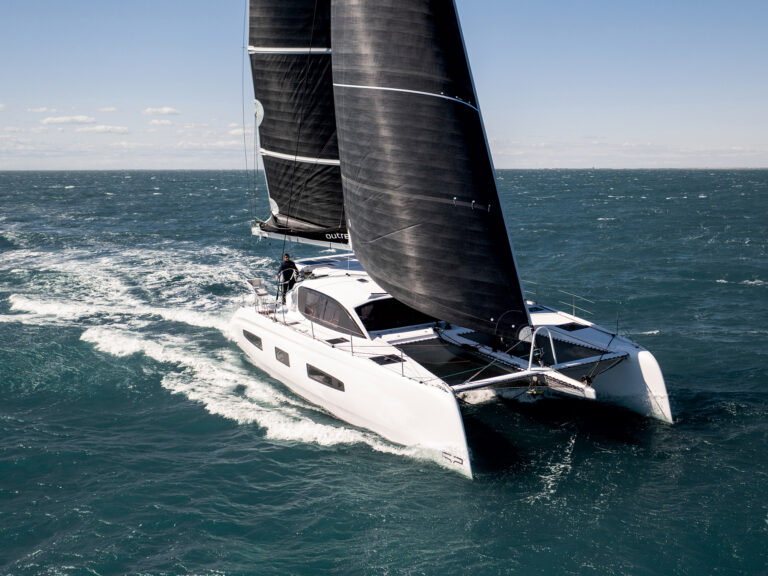
Sailboat Preview: Outremer 52
- Digital Edition
- Customer Service
- Privacy Policy
- Email Newsletters
- Cruising World
- Sailing World
- Salt Water Sportsman
- Sport Fishing
- Wakeboarding
- View Full Site
- Advertising
- Cookie Policy
- Privacy Statement
- Terms of Service
- Cars, Trucks & Boats
- Boating & Sailing
- Boat Repairs
Learn the Basics of Sailboat Navigation
- Written by Connor Doe on Dec 04, 2009 To ensure our content is always up-to-date with current information, best practices, and professional advice, articles are routinely reviewed by industry experts with years of hands-on experience. Reviewed by H.R. Helm on Feb 20, 2020
Operating a sailboat requires basic skills that can be mastered only with practice. To a certain extent, sailing knowledge can be learned theoretically, but that must be followed by hands-on practice or else the student will have no point of reference. Sailing is a skill that can take years to master. There are many subtleties to it and many small details to remember. The basics, however, can be picked up with a few lessons. The maneuvers are easy in principle, but their proper execution requires knowing them thoroughly.
Basic Navigation
The navigation of a sailboat involves a few simple to understand maneuvers. Basically, a sailboat can either be moving or not. Wind powers the sails, propelling the boat along the water. A sailboat has a finite number of points of sail or directions. These are towards the wind, perpendicular to the wind and with the wind. It is impossible to sail directly into the wind. Each of these points has a specific name which will follow. Turning the boat is another aspect. A sailboat can either turn its bow through the wind or its stern through the wind.
Points of Sail
There are 5 basic points of sail: close hauled, close reaching, beam reaching, broad reaching, and running.
- Close hauled sailing is as close as a boat can get to going into the wind. It is roughly 45 degrees to the wind.
- Reaching is the range of sailing perpendicular to the wind. Close reaching is nearer to the wind, beam reaching is 90 degrees to the wind and broad reaching is about 135 degrees from the wind.
- Running is the term that describes sailing with the wind.
Sailing directly into the wind is not possible. It is called being in irons, and your boat does not move forward.
Turning the Sailboat
As mentioned, the sailboat can turn one of 2 ways: bow or front through the wind or tail or stern through the wind. Taking the front end through the wind is called tacking or coming about. Taking the stern through the wind is called jibing. Both maneuvers require very specific actions of the crew’s part to keep the sails trimmed and maintain momentum. Turning towards the wind without going through it is called heading up, while turning away from the wind is called bearing away.
Stopping the Boat
The way to stop the boat while at sea is called heaving to. It requires similar actions as coming about, but the end result is that the boat cancels out its motion in relation to the wind.
Navigating a sailboat takes a lot of practice, but it really only involves a few maneuvers that are repeated over and over again. Learning to perform them accurately on a moment’s notice and without losing speed is what separates experienced sailors from novices. Knowing exactly what action to take in a tricky situation is another factor that distances pros from amateurs.
Related Posts
Popular articles.

- our experts
- terms of use
- privacy policy
- cookie policy
DoItYourself.com®, founded in 1995, is the leading independent home improvement and repair website. We welcome your comments and suggestions. All information is provided "AS IS." Website operating problems contact [email protected] . Questions of a Do It Yourself nature should be submitted to our " DoItYourself.com Community Forums ". Copyright© 1995-2024 MH Sub I, LLC dba Internet Brands. All rights reserved. You may freely link to this site, and use it for non-commercial use subject to our terms of use . View our Privacy Policy here .

- Gear Directory
- Multihull Sailor
- Boats for Sale
- Real Estate
- Maintenance & Hardware
- Water Sports
Navigate the Waters With the Best Marine GPS
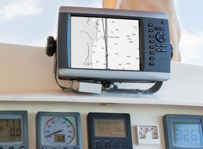
Safe traveling requires proper and accurate navigation, and this particularly holds when you are out on the water. Whether you are out on a fishing spree or riding a schooner, boat, or yacht exploring, a marine GPS keeps you on your intended route. So, the elite marine GPSes in 2024 should always make your priority checklist when heading out into the water.
Whether you are an amateur sailor or an experienced professional on the boat, a GPS utilizes satellite information to ensure that you are always on course. That said, finding the perfect marine GPS can be a tedious process, with the devices getting more advanced and feature-packed. Our comprehensive guide has all the answers, especially if you don’t know whether it’s a chart plotter, fish finder, or a mere tracker that you need.
Our Top Picks
- Best Overall: Humminbird HELIX 5 CHIRP GPS Shop Now ➔
- Most Accurate GPS: Garmin ECHOMAP Marine GPS Shop Now ➔
- Most Intuitive Interface: Simrad Cruise Marine Chartplotter Shop Now ➔
- 1 What Is a Marine GPS?
- 2 Chartplotter vs Fishfinder
- 3 Essential Factors in a Marine GPS
- 4 Device durability goes a long way
- 5 Choosing the right kind of GPS device
- 6 Screen dimensions and interface matters
- 7 Must-Have Marine GPS Features
- 8 Pre-loaded maps and charts
- 9 Sonar scanners and transducers
- 10 More advanced features
What is the purpose of CHIRP technology?
Do i need to get map upgrades and additional charts, is it difficult to understand the marine gps interface, related reviews, the premier marine gps models of 2024 in detail, best overall.
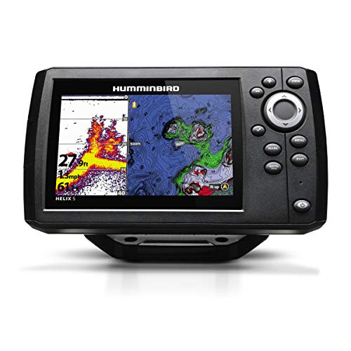
Humminbird HELIX 5 CHIRP GPS
This highly efficient and affordable marine GPS from Humminbird functions as both a chart plotter and fish finder, so you can always be ready for your next marine voyage. Features like higher resolution displays, enhanced target separation, and controlled image noise make the navigation via the Humminbird HELIX 5 GPS much more seamless.
This particular fish finder, with CHIRP sonar technology, ensures an in-depth screening up to 1,000 feet at multiple frequencies. It comes with preloaded maps and data, marking all possible entryway points, buoys, marinas, shores, and hazards. Furthermore, the built-in cartography tool allows advanced chart plotting, and the WAAS technology provides accurate fixes of global positioning within 8.2 feet. With amazing features rivaling its counterparts on a low budget, this is the best marine GPS on our list.
- MicroSD card allows additional map upgrades
- 5-inch widescreen for easy navigation
- Suitable for small to large-sized vessels
- Two different display modes
- Lacks a screen cover
Most Accurate GPS
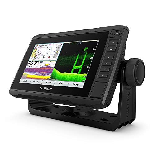
Garmin ECHOMAP Marine GPS
If you are looking for a fish finder and chart plotter combo, the Garmin ECHOMAP Marine GPS will be your ultimate navigation companion. This device offers exceptionally advanced and accurate GPS technology that instantly updates your coordinates. It’s an efficient navigation device that provides extensive coverage of US coastal areas.
The 7-inch wide sunlight-readable, tiltable screen and the heavy-duty mounting system make this device a perfect partner for venturing out into the ocean. Meanwhile, its high-tech sonar scanning Panoptix feature with GT24 transducers provides a clear vision of what’s underneath your vessel and around you. Additionally, the ECHOMAP GPS also allows you to create personalized maps.
- Features preloaded maps for US coasts
- Easy to access menu
- High-definition visual quality
- Enhanced target separation with CHIRP sonar technology
- Requires upgrade for areas outside the US coasts
Most Intuitive Interface
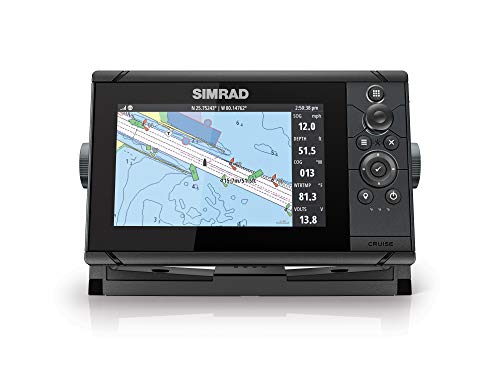
Simrad Cruise Marine Chartplotter
Are you on the lookout for an advanced chart plotter that offers sophisticated hardware and software features at an affordable price range? Then the Simrad Cruise Chartplotter is the answer to your navigation woes. This marine GPS will keep you on course with the preloaded US coastal maps and enhanced chart support from Navionics and C-Map when cruising through the water. Plus, the 83/200 transducer is preprogrammed to provide enhanced depth tracking automatically.
This GPS makes navigation a breeze with its intuitive control menu, rotary dial, and keypad design. The menu allows you to create customized routes and access information such as speed, temperature, and depth reading. What’s more, this topographical navigation device is particularly great for use over rough seas to always stay on course.
- Available in three different screen dimensions
- Works in high seas and coastal waters
- Split-screen for access to essential information
- Easy installation and mounting
- The depth finder needs improvement
Buying Guide: Marine GPS
You can’t have an oceanic adventure without a sophisticated navigation system onboard. Whether heading into the lake for fishing or breaching the coastal territories to experience rough seas and waves, a marine GPS prioritizes your safety and keeps you on your intended course.
Unfortunately, the newer features, cutting-edge technology upgrades, and different types can be overwhelming. Should you opt for a mounting device or a handheld, portable variant? Do you need a fish finder-chart plotter combo, or is just a GPS tracker enough for your voyage?
All of your questions are valid, and this buying guide addresses everything you need to know before getting yourself a marine navigation device.
What Is a Marine GPS?
Marine GPS is an umbrella term for navigation devices that track a vessel’s location in coastal bodies. The primary function of a global positioning system (GPS) device is to pinpoint the location of any boat over a body of water and provide information about the surroundings. Marine GPS tools include different variants such as GPS radio, chart plotters, and fishfinders.
Chartplotter vs Fishfinder
The two major categories of marine GPS are chart plotters and fishfinders, each serving specific functions. Mariners often opt for hybrid GPSes, which offer a combination of both variants in a single device. While getting a marine GPS that functions as both a chart plotter and fish finder enhances the device’s effectiveness, it also costs you a few extra bucks.
So, it’s important to explore the difference between both marine GPS variants. That way, you can determine whether you need a chart plotter, a fishfinder, or a hybrid.
A chart plotter is a navigation tool that utilizes GPS satellites to pinpoint your location when you are in a coastal area or surrounded by water. The chart plotting device utilizes map coordinates in relation to your speed and directional data to ensure that you are on your intended course. Thus, it minimizes the risk of getting lost or losing track when you are in the ocean.
Fishfinders are specifically for mariners who venture out into the water for fishing purposes. This device utilizes sonar scanning technology and transducers to pinpoint areas with a shoal of fish. If you are a dedicated angler, you’ll appreciate the chart plotter/fishfinder combo.
Essential Factors in a Marine GPS
Device durability goes a long way.
Marine GPS devices are mostly a one-time investment that may cost you some serious money. Therefore, you want a device that runs its natural course and provides optimal performance with perfect durability.
Most importantly, a premium-quality marine navigation device should be waterproof or water-resistant since wave splashes are expected in a vessel. Additionally, you can use protective covers over the GPS to keep it safe from water exposure and enhance its durability. A marine GPS with a waterproof rating ranging from IPX 0 to IPX8 ensures functionality, even when faced with moisture, humidity, or water exposure.
Choosing the right kind of GPS device
Besides chart plotters and fish finders , there are other types of marine GPS based on their mounting style and portability. The different kinds of marine GPS you can opt for can be a hand-held device, dash-mounted GPS, or a portable option, depending on your vessel size and usage.
Portable GPS devices make a great navigation companion for smaller boats like kayaks. Meanwhile, dashboard-mounted GPS devices work better for larger vessels with better features and sophisticated navigation measures.
Screen dimensions and interface matters
When you are aboard a vessel, the device’s screen dimension and interface matter a lot for ease of accessing data and information. Larger screen dimensions are more user-friendly and convenient for mariners.
Must-Have Marine GPS Features
Pre-loaded maps and charts.
Your marine GPS can cost you much more if it has pre-installed maps and charts, but they’re very useful. Preloaded maps make navigation more accurate, providing all the essential information regarding the area, hazards, and entry points. Also, users have to opt for map upgrades if they wish to utilize the device on international coasts, so most GPS devices come with an additional SD card for that purpose.
Sonar scanners and transducers
Suppose you are going for a fishfinder GPS. In that case, you need a high-quality transducer system and sonar scanning technology to provide accurate data on what’s beneath the water’s surface. One of the most recent technologies, CHIRP sonar, ensures proper depth range and is quite a popular feature in marine GPSes.
More advanced features
When your marine GPS has the best features, you can expect enhanced navigation and optimal performance. Wi-fi connectivity, distress signals, and a VHS transmitter further elevate the navigation experience. However, the choice of additional features depends on what you require from your marine GPS device.
People Also Asked
Abbreviated for compressed high-intensity radar pulse (CHIRP), this sonar tech utilizes multiple frequency levels, providing detailed imaging and clarity of what’s beneath the surface. CHIRP technology is most effective for fishfinders.
Most marine GPS manufacturers offer preloaded maps of the US and surrounding coastal areas. Map upgrades aren’t required if you are in the US and adjoining territories. But, if you are exploring international coasts, you might need some additional map and chart upgrades.
If you are a nautical newbie, a marine GPS interface can have a bit of a learning curve. With the complex functions navigational GPS devices serve, it’s understandable for mariners to take their time to understand the device’s interface. That said, reputed brands and manufacturers always ensure an easy-to-decipher interface, high-definition visuals, and intuitive menu controls to get the most out of navigation devices.
Article Contributors
Sail magazine review team.
SAIL Magazine Review Team reports on best-selling products in sailing and boating. SAIL Magazine is reader-supported: When you buy through links on our site, we may earn an affiliate commission. Artificial Intelligence (large language models) may have been used in the research and creation of the content.
To ensure questions about product testing or a specific article are addressed, please contact [email protected]
You are either using a browser that does not support JavaScript, or you have disabled JavaScript. OpenSeaMap uses JavaScript for its maps.
VAR 3.5°5'E (2015)
ANNUAL DECREASE 8'
- Map with JOSM Remote
- Tidal Scale
- Aerial photo
- Coordinate Grid
- Elevation Profile
- Marine Profile (1:920.000)
- Marine Traffic
- Compass Rose
- Depth contours (beta)
- Water depth
- OpenCPN (Kap)
- Navico (Lowrance, Simrad, B&G)
- Trip Planner
- Bridges/Locks

Please verify you are a human
Access to this page has been denied because we believe you are using automation tools to browse the website.
This may happen as a result of the following:
- Javascript is disabled or blocked by an extension (ad blockers for example)
- Your browser does not support cookies
Please make sure that Javascript and cookies are enabled on your browser and that you are not blocking them from loading.
Reference ID: c3ac390a-07eb-11ef-a7bc-5e999ef840ea
Powered by PerimeterX , Inc.

- The Star ePaper
- Subscriptions
- Manage Profile
- Change Password
- Manage Logins
- Manage Subscription
- Transaction History
- Manage Billing Info
- Manage For You
- Manage Bookmarks
- Package & Pricing
Flood rescue volunteers pick up boat handling, navigation tips in Civil Defence course
Wednesday, 01 May 2024
Related News

Phenol gas leak: Four Factory workers rushed to hospital
Kenya evacuates tourists stuck in flooded wildlife sanctuary, kenya flood toll rises to 181 as homes and roads are destroyed.
MELAKA: Dozens of flood rescue workers from a Kuala Lumpur-based group got the opportunity to improve their boat handling skills during a navigation course at Klebang here.
Melaka Civil Defence Force Associate Corporate Officers chairman Associate Kol (PA) Mike Thien said more than 30 volunteers were given hands-on training in handling and navigating boats safely during the two-day course.
"The training was aimed at improving the volunteers' skills as well as to develop individual awareness and commitment to safe navigation in flood situations.
"In addition, we are planning more advanced courses such as safe navigation at sea and using marine radio to communicate," he said after the end of the course here on Wednesday (May 1).
Participants received their certificates from state Civil Defence Force director Lt Kol (PA) Kamarulsyah Muslim.
Thien said the participants were volunteers from the Federation of Moral Uplifting Associations of Malaysia who wanted insights on emergency measures, basic navigation and safety procedures during rescue missions.
The training also touched on launching, operating and docking rescue boats in waterways, as well as fast rescue techniques and basic vessel maintenance.
"It was a great course that taught the volunteers how to apply basic small boat and rescue skills in emergencies,” he added.
Tags / Keywords: Rescue Workers , Floods , Volunteers , Training , Melaka Civil Defence Force , Klebang , Associate Kol (PA) Mike Thien , Boat Handling , Navigation , Rescue Techniques , Emergencies , Federation of Moral Uplifting Associations of Malaysia
Found a mistake in this article?
Report it to us.
Thank you for your report!

Martell celebrates the Year Of The Dragon with its most exceptional Cognac yet
Next in nation.

Trending in News
Air pollutant index, highest api readings, select state and location to view the latest api reading.
- Select Location
Source: Department of Environment, Malaysia
Others Also Read
Best viewed on Chrome browsers.

We would love to keep you posted on the latest promotion. Kindly fill the form below
Thank you for downloading.
We hope you enjoy this feature!
- Share full article
Advertisement
New York Today
Model-boat sailing returns to central park.
I tried operating a boat on Conservatory Water, the pond famous for model boating. It’s harder than it looks.

By James Barron
Good morning. It’s Wednesday. We’ll look at the return of model boating in Central Park for the first time since the pandemic. We’ll also get details of the penalty that Donald Trump was ordered to pay for breaking the gag order in his criminal trial .

And then I crashed the boat.
It wasn’t my fault. Really, it wasn’t. A puff of wind came out of nowhere and drove the boat into the stone wall I had been steering it toward. Gently. Smoothly.
The vessel I was captaining was not a cruiser with an engine whirring below deck — it had no engine at all. Mine was a miniature sailboat on the model boat pond in Central Park, the setting famous from E.B. White’s story “Stuart Little.”
Model boats are being rented on the pond for the first time since 2019, the last full year before the coronavirus hit. The concessionaire is new: Rocking the Boat, a nonprofit from the Hunts Point section of the Bronx. The organization also teaches teenagers how to build full-size boats for rowing and sailing and how to pilot them on Long Island Sound.
Jasmine Benitez, who is managing Rocking the Boat’s operation at the boathouse east of the pond, said that the transition from the Sound to the diminutive world of the model boat lake (officially, Conservatory Water) had not been difficult. “The physics is exactly the same as on a big boat,” she said.
Physics? Yes, physics, said Sue Donoghue, the parks commissioner, adding that Rocking the Boat’s workshops introduce “the importance of STEM in a fun way,” referring to science, technology, engineering and mathematics. Teams from Rocking the Boat assemble the three-and-a-half-foot-long model vessels from components. The group plans to conduct workshops to teach people how to build their own.
Adam Green, the founder and executive director of Rocking the Boat, said that the operation in Central Park was a departure for the group — its first venture in Manhattan. Rocking the Boat is charging Manhattan prices, $15 for 30 minutes of sailing. The price was $13 in 2019, he said, adding, “We thought it was obvious that everything is more expensive now.”
Green said that he was counting on model boats to boost the name recognition of Rocking the Boat and to bring in revenue for the organization’s programs. Starting today, Rocking the Boat will rent sailboats on Wednesdays and Fridays from 11 a.m. to 7 p.m. Next month, it will add Thursdays and Saturdays to the schedule, and in July, the operation will expand to five days a week, from Wednesday to Sunday. The rentals are separate from races organized by the Central Park Model Yacht Club on Saturdays, from 10 a.m. to 1 p.m.
People can also bring their own boats during Rocking the Boat hours, but they need a $15 permit from the city’s parks department.
Green, 50, grew up on the Upper West Side and said that, when he was a child, he climbed all over the Alice in Wonderland statue just north of the pond. But he did not pay much attention to what was going on in the boathouse that Rocking the Boat is now using by Conservatory Water.
“As a New Yorker,” he said, “you never think about something like this existing here.”
The boathouse was built in the 1950s. Conservatory Water, one of the man-made wonders that Calvert Vaux and Frederick Law Olmsted created, dates to the 19th century. Despite its age, the pond is not littered with (model) shipwrecks — it is not terribly deep. But boats can capsize.
I did not want that to happen when Benitez handed me the remote-control device used to control the miniature sailboat that she and Myah Recinos had placed in the water. The device looked something like an Xbox controller.
“I’m more of a PlayStation girl myself,” said Recinos, a Rocking the Boat veteran who is renting the boats and, as she put it, “helping people get them going.” People like me.
I had also read that the winds on the model boat basin are typically 3 to 6 knots, but at that moment there was not even a whisper. “Patience is key to dealing with these boats,” Recinos counseled. “When the wind dies out, you have to be patient.”
So I waited, and after a minute or two, a breeze carried the boat out. I maneuvered the controls. The boat zipped along nicely. I worked the remote control to turn the boat to head back.
Bad idea. At least the stern had what Recinos called a “nose,” a rubbery cone designed to absorb the shock of a slow-speed mishap.
“You cannot control the wind,” Recinos told me later. “You thought you were doing really bad when I didn’t think you were. I remember you crashing into the wall, and I was like, That’s pretty much bound to happen at some point.
Expect a cloudy day with temperatures in the high 60s. At night, the clouds will linger, and temperatures will drop to the low 50s.
ALTERNATE-SIDE PARKING
In effect until tomorrow, Holy Thursday (Orthodox).
The latest New York news
Arrests at Columbia : Police officers in riot gear arrested protesters occupying a building at Columbia University. The school said that the building had been “vandalized and blockaded,” leaving officials “no choice” but to call in the police for the second time in less than two weeks.
Abuse lawsuits: About 150 people filed lawsuits against New York City agencies, saying that they had endured abuse while in the city’s custody as minors in juvenile detention centers and on Rikers Island.
More scrutiny of judges? : A criminal justice group that led the fight against Gov. Kathy Hochul’s first choice to lead the state’s highest court last year is pressing for closer scrutiny of judges.
Sentenced for funding terrorism : A 44-year-old woman was sentenced to 18 years in prison on Tuesday for funding terrorism by using cryptocurrency. Prosecutors said that she had sent funds to Bitcoin wallets controlled by a terrorist training group operating in Syria.
Tied for the most Tony nominations: The semi-autobiographical Alicia Keys musical “Hell’s Kitchen” and “Stereophonic,” a play about a group of musicians struggling to record an album, each got 13 Tony nominations .
For Trump, a $9,000 fine for violating a gag order
The judge in Donald Trump’s hush-money trial held the former president in contempt and fined him $9,000 for violating a gag order with his social media posts.
Judge Juan Merchan also warned Trump of “incarceratory punishment” if he were to flout the gag order from now on — meaning jail.
For Trump, $9,000 is not much money. Merchan said so himself, in an eight-page decision. The penalties for repeatedly violating the gag order “unfortunately will not achieve the desired result” when the person penalized can easily afford the fine, Merchan said.
The judge ordered Trump to remove nine “offending posts” from his Truth Social account and his campaign website. In doing so, Merchan rejected claims by Trump’s lawyers that the former president had simply reposted messages written by others. Merchan called the idea that such reposts do not count as violations of the gag order “counterintuitive and indeed absurd.”
The jury heard from Keith Davidson, the lawyer who represented two women who claimed to have had sex with Trump: Stormy Daniels, a porn actress, and Karen McDougal, a Playboy model. Davidson’s testimony has pulled back the curtain on the negotiations for the hush-money payments made to both women ahead of the 2016 presidential election.
METROPOLITAN diary
Passing it on
Dear Diary:
Whenever I finish reading a magazine and it is in clean condition, I face a dilemma: Recycle it or leave it on a park bench or subway seat for someone else to enjoy?
By leaving it somewhere, I could be doing a public service. Or I could just be making trash for someone else to clean up.
One day not long ago, the question was answered for me as I watched.
I was sprinting to make a transfer at Columbus Circle when the magazine I had been reading flew out of my coat pocket and fell to the ground. Wanting to make my train, I decided not to stop to pick it up.
As the doors closed, I watched sheepishly while people streamed past my litter.
But just before the train pulled out, I saw a woman stop and examine the cover. Then she bent down, picked up the magazine and slipped it into her bag.
— Ryan Kailath
Illustrated by Agnes Lee. Send submissions here and read more Metropolitan Diary here .
Glad we could get together here. See you tomorrow. — J.B.
P.S. Here’s today’s Mini Crossword and Spelling Bee . You can find all our puzzles here .
Francis Mateo, Rachel Gomes and Ed Shanahan contributed to New York Today. You can reach the team at [email protected] .
Sign up here to get this newsletter in your inbox.
James Barron writes the New York Today newsletter, a morning roundup of what’s happening in the city. More about James Barron
- Grand Rapids/Muskegon
- Saginaw/Bay City
- All Michigan
More victims in fatal boat club crash join lawsuit, multiple defendants named
- Published: May. 01, 2024, 11:42 a.m.

(File photo | MLive.com) MLive file photo
- Matt Durr | [email protected]
MONROE COUNTY, MI -- Seven people who were injured last month when a car crashed through the wall of the Swan Creek Boat Club have joined a lawsuit against the driver of the car and multiple other defendants. An amended version of a lawsuit filed last week in Monroe County Circuit Court names seven more plaintiffs -- identified as Denise Roberts, Martin Roberts, Patricia Raths, Alyssa Sigler, Lia Stith, Josh Stith and Kathy Stigler -- who were seriously injured in the crash.
The lawsuit was originally filed last week by Mariah Dodds, the mother of the two children killed in the crash. The civil lawsuit alleges the driver of the car, Marshella Chidester, 66, was under the influence when she crashed through the wall and hit multiple people with her car. A local tavern that Chidester visited prior to the crash was also named in the original lawsuit.
Eight-year-old Alanah Phillips and her 4-year-old brother, Zayn Phillips, were killed in the crash and several others were injured.
The amended lawsuit now names the boat club itself as a defendant with lawyers arguing the building was not up to code, it was built near a roadway with no guard rail in place, and that other safety measure were not properly taken.
Multiple insurance companies have also been named in the amended lawsuit with lawyers accusing the agencies of failing to pay for injuries suffered by their clients.
Chidester was charged last week with two counts of second-degree murder along with six other felonies. On Tuesday, a judge delayed the preliminary exam in the criminal case until late June after Chidester’s attorney Bill Colovos asked for additional time to prepare due to the extraordinary amount of discovery in the case.
Chidester is currently free after posting a $1.5 million bond last week.
Stories by Matt Durr
- 87-year-old Oakland County woman wins $682K Lottery prize on weekly ticket purchase
- Hit-and-run driver in Northern Michigan goes into horse pasture
- Exam delayed by 2 months for woman charged in fatal boat club crash
If you purchase a product or register for an account through a link on our site, we may receive compensation. By using this site, you consent to our User Agreement and agree that your clicks, interactions, and personal information may be collected, recorded, and/or stored by us and social media and other third-party partners in accordance with our Privacy Policy.
Stranded boat finally rescued from Washington beach
- Updated: May. 01, 2024, 10:30 a.m. |
- Published: Apr. 30, 2024, 1:29 p.m.
- Mark Graves | The Oregonian/OregonLive
- Mims Copeland | The Oregonian/OregonLive
Ocean Park, Washington, has one fewer oceanfront residence as of yesterday.
On April 12, Michael Bonome’s boat ran ashore after it suffered engine trouble amid high waves. Bonome was making his way to the back of the boat to drop anchor when he realized that his dog had fallen into the water and jumped in after it, according to KPTV .
If you purchase a product or register for an account through a link on our site, we may receive compensation. By using this site, you consent to our User Agreement and agree that your clicks, interactions, and personal information may be collected, recorded, and/or stored by us and social media and other third-party partners in accordance with our Privacy Policy.
University of Texas Athletics

No. 1 Rowing’s I Eight earns Big 12 Boat of the Week honors
The Longhorns’ First Eight collected the honor for the second time this season.
IRVING, Texas – No. 1 Texas Rowing's First Eight was named the Big 12 Boat of the Week, the conference office announced on Wednesday. The Longhorns were selected for the weekly honor after defeating then-No. 1 and defending national champion Stanford at the Longhorn Invite on Saturday. It marked the second time this season in which Texas' I Eight has earned the honor and the third time overall for the Longhorns.
The Texas I Eight featured senior coxswain Carly Legenzowski , as well as graduate student Mette Nielsen , graduate student, Lanie Nitsch , senior Anna Jensen , graduate student Etta Carpender , sophomore Marg Van der Wal , sophomore Abby Dawson , fifth-year Cassandre Korvink-Kucinski and senior Amber Harwood .
UT defeated defending First Eight national champion Stanford in head-to-head competition at the Longhorn Invite, while also topping the times of Virginia and Ohio State.
Racing was impacted by high crosswinds of 10-14 mph on the course and gusts of 20 mph, forcing an adjusted schedule in which the teams' three NCAA boats – First Eight, Second Eight, First Four – competed in two heats instead of one grand final.
Texas came away with the victory in the I Eight, crossing the line in 6:00.969 to win by open water over a Stanford crew that posted a time of 6:03.353. The Cardinal were in front at the midway mark, but Texas surged over the final half of the course to top Stanford. Ohio State was the winner in heat two, posting a time of 6:20.922 with Virginia taking second in 6:26.766.
The Texas I Eight previously earned conference Boat of the Week honors after a dominating performance at the San Diego Crew Classic , while the II Eight collected the accolade after an impressive victory at No. 9 Michigan .
On deck for Texas is the Big 12 Rowing Championship where the Longhorns will seek a ninth consecutive Big 12 title. The regatta will be held on Sunday, May 19 in Sarasota, Fla. at Nathan Benderson Park, the site where the Longhorns won the 2021 and 2022 NCAA Championships.

Thanks for visiting !
The use of software that blocks ads hinders our ability to serve you the content you came here to enjoy.
We ask that you consider turning off your ad blocker so we can deliver you the best experience possible while you are here.
Thank you for your support!
- Anniston/Gadsden
Popular cruise line cancels trip with guests already on board: What happens next?
- Updated: Apr. 30, 2024, 10:05 p.m. |
- Published: Apr. 29, 2024, 6:38 a.m.

FILE - In this June 20, 2016 file photo, the Royal Caribbean cruise ship Empress of the Seas heads out of PortMiami, in Miami Beach, Fla. Royal Caribbean International notified guests aboard Radiance of the Sea the ship will not continue on an already-abbreviated Alaska sailing. Instead, the voyage was canceled and guests must leave the ship and will be sent home. AP
- Leada Gore | [email protected]
Guests onboard a popular cruise line were told their trip was canceled and they were being sent home despite already being on board the vessel.
Royal Caribbean International notified guests aboard Radiance of the Sea the ship will not continue on an already-abbreviated Alaska sailing. Instead, the voyage was canceled and guests had to leave the ship and be sent home, CruiseHive.com reported.
The ship was set to depart Vancouver, British Columbia on Friday and guests were permitted on board. It was announced the ship would spend two days in port undergoing repair with a revised departure date of Sunday, April 28 before returning May 3 as planned.
Later, however, an announcement was made the trip was being canceled due to repairs for a technical issue impacting its propulsion, the website reported, and guests had to leave the ship Sunday by 4 p.m. local time.
“As you are aware, our teams have been vigorously working to have Radiance of the Seas prepared to set sail on our shortened April 26th sailing,” a letter given to passengers in their staterooms read, according to reports by unofficial cruise site RoyalCaribbeanBlog.com reported. “Despite our best efforts, circumstances beyond our control have delayed our sailing further. As a result, we’ll regrettably have to cancel our April 26th, 2024 cruise.”
READ MORE: U.S. travel alert: Cruise line cancels more visits to popular Caribbean destination
What happens to the guests?
Guests will receive a 100% refund on their fare and a 100% future cruise credit for a later sailing. The cruise line opened internet service free of charge to allow for easier travel planning and offered a free open bar until debarkation, reports indicated.
Cruisers who booked flights through Royal Caribbean had their flights automatically rescheduled. The cruise line is also reimbursing any travel change fees up to $250 for domestic travel and $400 for international travel and up to $250 for hotel costs, per statement, per night, for two nights.
READ MORE: U.S. travel alert: Do not travel to this Caribbean nation, popular spot for cruise ship stops
The ship first developed propulsion difficulties last week during a repositioning cruise from Los Angeles to Vancouver, causing several stops to be scrapped to accommodate the slower speed.
If you purchase a product or register for an account through a link on our site, we may receive compensation. By using this site, you consent to our User Agreement and agree that your clicks, interactions, and personal information may be collected, recorded, and/or stored by us and social media and other third-party partners in accordance with our Privacy Policy.

IMAGES
VIDEO
COMMENTS
In order to learn marine navigation, you need to understand how to locate your position (using bearings, GPS, stars, etc.), how to read nautical charts to determine a course, how to plot a course on a nautical chart or chartplotter, and how to use a compass (in order to monitor the course). This still might seem like a lot.
GPSMAP® 86sci. This handheld marine GPS provides everything you need for a safe day out on the water. With its built-in inReach® Satellite Communicator 1, it also acts as an emergency beacon. Install it at your helm or take it with you to a different boat — portable marine navigation, made easy.
2. iNavX. Easy to confuse with Navionics (especially when downloading the app), iNavX is a whole different animal. There's a $5 charge to download the app, and then you can download NOAA raster charts for free and vector charts (powered by Navionics and C-MAP) for a fee. Beyond navigation, details on marinas, fuel docks and other facilities ...
Whether you're just dipping your toe into sailing or full-on club racing, explore the best electronics for sailing - from navigation to safety equipment. Discover the right sailboat electronics package for any size or type boat, dinghy to keelboat. Choose from an assortment of technologies that can make your time on the sea feel like a breeze.
Watch our Basic Boat Navigation: Creating a Route with Bearings to Navigate By Video. Determine a Reciprocal Course: This is one of the simpler navigation tasks, but it's also quite important. If you don't know your reciprocal (reverse) course, you can't go back the way you came. Since your compass has 360 degrees, the reciprocal of ...
iSailor. iSailor is another app that works well as an extension to your boat's onboard systems. It will connect to the NMEA system and internet AIS, although each feature you unlock costs money ...
The home of B&G Sailing. The leading manufacturer of Sailing Electronics including Chartplotters, Instruments & Autopilots around the world. ... Superfast smart, dual-screen multifunctional navigation system. Learn more. Wind Sensors Spares & Accessories Sailing Processors The Ultimate Sailing Systems . Racing. Coastal Sailing. Offshore Sailing ...
This is the only navigation course to be completely vetted by the US Coast Guard Navigation Center. Sign up and start Navigating like a pro today! ... towards your dream of sailing the Seven Seas or you just want to understand what your friends are saying on your next sailboat outing, Sailing Lingo is the perfect way to get your feet wet. ...
How to Navigate a Boat. Decide on your method: electronic navigation or traditional (analog) navigation. If using electronic navigation, start by operating your GPS or chartplotter. Make note of your real-time position, speed and direction of travel. To get from point "A" to point "B," create a waypoint. String waypoints together to create a ...
Cost: $9.99. Pros: Easy to use with no frills; road maps are useful for trailer boaters. Cons: Android only; road maps require access to network. Navionics. Probably the most popular navigation app, Navionics utilizes vector charts and allows the user to connect to some chartplotters via Wi-Fi to transfer routes and waypoints.
Orca is navigation for the modern boater. Meticulously designed to help you plan and find your way at sea, without getting in your way. Home. Display 2. Core 2. Why Orca ... Bringing peace of mind to all boat owners. April 11, 2024 • 2 min. Introducing Rerouting for Sail Routes. A new approach to navigation for sailboats. April 4, 2024 • 2 min.
As such a power boat, and by extension all sailboats, MUST, without question show one green light on the starboard bow and one red light on the port bow and one all around white light or lights while operating in reduced visibility. These lights should shine at all 360 degrees of visibility with the bow lights shining at an angle of dead ahead ...
Rule 12 - Sailing Vessels. (a) When two sailing vessels are approaching one another, so as to involve risk of collision, one of them shall keep out of the way of the other as follows: when each has the wind on a different side, the vessel which has the wind on the port side shall keep out of the way of the other; when both have the wind on ...
We have a range of merchandise to suit the whole family, on or off the water. savvy navvy app is Google Maps for boats. Charts, tides, weather, and everything you need for sailing and motorboat navigation in one place!
Four Basic Navigation Rules for Sailing Situations. Port-tack boat gives way to the starboard-tack boat - upwind or downwind. If two vessels might come close or collide, the stand-on vessel maintains course and speed. The give-way vessel alters course and/or speed to pass at a safe distance. (see Image 1 below) Windward boat gives way to the ...
The largest boat in our fleet, the Oyster 745, also features one of the largest nav stations among the monohulls. This aft-facing desk area, on the port side of the companionway, will serve its owners and crew as an ample office space. This station has room for two large multifunction displays, plus smaller instruments.
Nautical Charts and Cruising Guides, Marine Electronics, Plotting and Weather Software, and Boating Safety Gear for Power and Sail.
We rely on eyeball navigation with a lookout on the bow. It is best to explore unknown areas on clear days with the sun high up in the sky, and when coral heads (frequently called bommies) gleam out from afar in the dark blue of the lagoon. Polarized sunglasses filter away reflections and improve visibility.
Basic Navigation. The navigation of a sailboat involves a few simple to understand maneuvers. Basically, a sailboat can either be moving or not. Wind powers the sails, propelling the boat along the water. A sailboat has a finite number of points of sail or directions. These are towards the wind, perpendicular to the wind and with the wind.
Join me on a comprehensive sailing lesson. I teach you the basics you need to know to begin sailing, from vocabulary and parts of the boat to getting underwa...
Humminbird HELIX 5 CHIRP GPS. This highly efficient and affordable marine GPS from Humminbird functions as both a chart plotter and fish finder, so you can always be ready for your next marine voyage. Features like higher resolution displays, enhanced target separation, and controlled image noise make the navigation via the Humminbird HELIX 5 ...
VAR 3.5°5'E (2015) ANNUAL DECREASE 8' Edit. Map with JOSM Remote; View. Weather; Sea Marks; Harbours; Sport; Aerial photo; Coordinate Grid
GPS is a satellite-based navigation system that provides accurate position fixes 24-hours a day on land, sea and air in any weather with no subscription or fee. This nominal constellation features 32 satellites in medium Earth orbit (MEO) 12,550 miles above the earth. Using timing signals sent by the satellites and knowing the exact orbital ...
JOHNS COUNTY, Fla — A sailboat stranded at a Florida state park is creating a sight to see for beachgoers. The 40-foot sailboat is beached in St. Johns County at Anastasia State Park after ...
Wednesday, 01 May 2024. 5:49 PM MYT. MELAKA: Dozens of flood rescue workers from a Kuala Lumpur-based group got the opportunity to improve their boat handling skills during a navigation course at ...
Mine was a miniature sailboat on the model boat pond in Central Park, the setting famous from E.B. White's story "Stuart Little.". Model boats are being rented on the pond for the first time ...
Exam delayed by 2 months for woman charged in fatal boat club crash Lucky for Life ticket worth $25K a year sold in Lenawee County If you purchase a product or register for an account through a ...
Boat washed ashore removed from Long Beach, Wash., April 2024 Mark Graves/The Oregonian. Ocean Park, Washington, has one fewer oceanfront residents as of yesterday. On April 12, Michael Bonome's ...
The Longhorns' First Eight collected the honor for the second time this season. IRVING, Texas - No. 1 Texas Rowing's First Eight was named the Big 12 Boat of the Week, the conference office announced on Wednesday. The Longhorns were selected for the weekly honor after defeating then-No. 1 and defending national champion Stanford at the ...
AP. Guests onboard a popular cruise line were told their trip was canceled and they were being sent home despite already being on board the vessel. Royal Caribbean International notified guests ...